Jabbeke geodata
Jabbeke (Flanders) is a populated place; located in Belgium in Europe/Brussels (GMT+2) time zone. With population of 13,488 people, there are 221 cities with bigger population in this country. Compared to other cities in Belgium, 88.8% of cities are located further ↓South; 95.1% of cities are located further →East and 93.3% of cities have higher elevation than Jabbeke. Note1
Administrative division(s):
- Level 1: Flanders
- Level 2: Provincie West-Vlaanderen
- Level 3: Arrondissement Brugge
- Level 4: Jabbeke


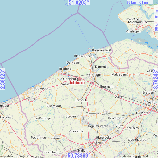
Jabbeke GPS coordinates[2]
51° 10' 54.66" North, 3° 5' 21.66" East
| Map corner | latitude | longitude |
|---|---|---|
| Upper-left | 51.6205°, | 2.38623° |
| Center: | 51.18185°, | 3.08935° |
| Lower-right: | 50.73899°, | 3.79248° |
| Map W x H: | 98×98 km | = 60.9×60.9mi |
| max Lat: | 51.46791° ⇑11.2% North |
| Jabbeke: | 51.18185° |
| min Lat: | ⇓88.8% South 49.53771° |
| min Long | Jabbeke | max Long |
| 2.59368° | 3.08935° | 6.25749° |
| W 4.9%⇐ | ⇒95.1% E |
Elevation
Elevation of Jabbeke is 7 m = 23 ft, and this is 92.5 m = 303 ft below average elevation for this country.
| Max E: |
582 m = 1909 ft | 93.3% |
| Avg. | 99.5 m = 326 ft | |
| Jabbeke | 7 m = 23 ft | |
Min E: |
1 m = 3 ft | 6.7% |
See also: Belgium elevation on elevation.city.
Geographical zone
Jabbeke is located in North temperate zone (between Tropic of Cancer and the Arctic Circle). Distance of this North polar circle is 1710.3 km =1062.7 mi to North.| Distance of | km | miles | from Jabbeke |
|---|---|---|---|
| North Pole | 4316.2 | 2682 | to North |
| Arctic Circle | 1710.3 | 1062.7 | to North |
| Tropic Cancer | 3085 | 1916.9 | to South |
| Equator | 5690.9 | 3536.2 | to South |


Nearby cities:
15 places around Jabbeke: (largest is in red/bold)
• Blankenberge
14.9 km =9.3 mi,  11°
11°
• Bredene
9.9 km =6.2 mi,  306°
306°
• Brugge
9.9 km =6.2 mi,  72°
72°
• De Haan
10.8 km =6.7 mi,  339°
339°
• Gistel
9.2 km =5.7 mi,  251°
251°
• Ichtegem
10.9 km =6.8 mi,  208°
208°
• Koekelare
12.8 km =8 mi,  217°
217°
• Oostkamp
10.4 km =6.5 mi,  107°
107°
• Ostend
11.9 km =7.4 mi,  288°
288°
• Oudenburg
6.2 km =3.9 mi,  273°
273°
• Sint-Kruis
11.7 km =7.3 mi, 72°
• Torhout
13 km =8.1 mi,  176°
176°
• Wenduine
13 km =8.1 mi,  357°
357°
• Zedelgem
5.5 km =3.4 mi,  143°
143°
• Zuienkerke
10.3 km =6.4 mi,  26°
26°
Sources, notices
• [Note1] Compared only with cities in Belgium existing in our database
• [Src1] Map data: © OpenStreetMap contributors (CC-BY-SA)
• [Src2] Other city data from geonames.org with taken over terms of usage.
• [Src3] Geographical zone / Annual Mean Temperature by Robert A. Rohde @ Wikipedia
