De Haan geodata
De Haan (Flanders) is a populated place; located in Belgium in Europe/Brussels (GMT+2) time zone. With population of 11,766 people, there are 254 cities with bigger population in this country. Compared to other cities in Belgium, 95.8% of cities are located further ↓South; 96.2% of cities are located further →East and 93.3% of cities have higher elevation than De Haan. Note1
Administrative division(s):
- Level 1: Flanders
- Level 2: Provincie West-Vlaanderen
- Level 3: Arrondissement Oostende
- Level 4: De Haan


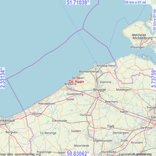
De Haan GPS coordinates[2]
51° 16' 21.396" North, 3° 2' 4.056" East
| Map corner | latitude | longitude |
|---|---|---|
| Upper-left | 51.71039°, | 2.33134° |
| Center: | 51.27261°, | 3.03446° |
| Lower-right: | 50.83062°, | 3.73759° |
| Map W x H: | 97.8×97.8 km | = 60.8×60.8mi |
| max Lat: | 51.46791° ⇑4.2% North |
| De Haan: | 51.27261° |
| min Lat: | ⇓95.8% South 49.53771° |
| min Long | De Haan | max Long |
| 2.59368° | 3.03446° | 6.25749° |
| W 3.8%⇐ | ⇒96.2% E |
Elevation
Elevation of De Haan is 7 m = 23 ft, and this is 92.5 m = 303 ft below average elevation for this country.
| Max E: |
582 m = 1909 ft | 93.3% |
| Avg. | 99.5 m = 326 ft | |
| De Haan | 7 m = 23 ft | |
Min E: |
1 m = 3 ft | 6.7% |
See also: Belgium elevation on elevation.city.
Geographical zone
De Haan is located in North temperate zone (between Tropic of Cancer and the Arctic Circle). Distance of this North polar circle is 1700.2 km =1056.5 mi to North.| Distance of | km | miles | from De Haan |
|---|---|---|---|
| North Pole | 4306.1 | 2675.7 | to North |
| Arctic Circle | 1700.2 | 1056.5 | to North |
| Tropic Cancer | 3095.1 | 1923.2 | to South |
| Equator | 5701 | 3542.4 | to South |


Nearby cities:
15 places around De Haan: (largest is in red/bold)
• Blankenberge
8.2 km =5.1 mi,  56°
56°
• Bredene
5.9 km =3.7 mi,  224°
224°
• Brugge
15 km =9.3 mi,  118°
118°
• Damme
17.3 km =10.7 mi,  97°
97°
• Gistel
13.9 km =8.6 mi,  200°
200°
• Jabbeke
10.8 km =6.7 mi,  159°
159°
• Knokke-Heist
18.3 km =11.4 mi, 61°
• Middelkerke
17.8 km =11.1 mi,  236°
236°
• Ostend
9.8 km =6.1 mi,  229°
229°
• Oudenburg
10 km =6.2 mi,  193°
193°
• Sint-Kruis
16.3 km =10.1 mi,  113°
113°
• Wenduine
4.4 km =2.7 mi,  49°
49°
• Zedelgem
16.1 km =10 mi,  153°
153°
• Zeebrugge
12 km =7.5 mi, 58°
• Zuienkerke
8.4 km =5.2 mi, 95°
Sources, notices
• [Note1] Compared only with cities in Belgium existing in our database
• [Src1] Map data: © OpenStreetMap contributors (CC-BY-SA)
• [Src2] Other city data from geonames.org with taken over terms of usage.
• [Src3] Geographical zone / Annual Mean Temperature by Robert A. Rohde @ Wikipedia
