Blankenberge geodata
Blankenberge (Flanders) is a populated place; located in Belgium in Europe/Brussels (GMT+2) time zone. With population of 18,230 people, there are 139 cities with bigger population in this country. Compared to other cities in Belgium, 96.9% of cities are located further ↓South; 94.2% of cities are located further →East and 96% of cities have higher elevation than Blankenberge. Note1
Administrative division(s):
- Level 1: Flanders
- Level 2: Provincie West-Vlaanderen
- Level 3: Arrondissement Brugge
- Level 4: Blankenberge


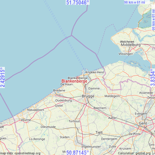
Blankenberge GPS coordinates[2]
51° 18' 47.016" North, 3° 7' 56.172" East
| Map corner | latitude | longitude |
|---|---|---|
| Upper-left | 51.75046°, | 2.42915° |
| Center: | 51.31306°, | 3.13227° |
| Lower-right: | 50.87145°, | 3.8354° |
| Map W x H: | 97.7×97.7 km | = 60.7×60.7mi |
| max Lat: | 51.46791° ⇑3.1% North |
| Blankenberge: | 51.31306° |
| min Lat: | ⇓96.9% South 49.53771° |
| min Long | Blankenberge | max Long |
| 2.59368° | 3.13227° | 6.25749° |
| W 5.8%⇐ | ⇒94.2% E |
Elevation
Elevation of Blankenberge is 6 m = 20 ft, and this is 93.5 m = 307 ft below average elevation for this country.
| Max E: |
582 m = 1909 ft | 96% |
| Avg. | 99.5 m = 326 ft | |
| Blankenberge | 6 m = 20 ft | |
Min E: |
1 m = 3 ft | 4% |
See also: Belgium elevation on elevation.city.
Geographical zone
Blankenberge is located in North temperate zone (between Tropic of Cancer and the Arctic Circle). Distance of this North polar circle is 1695.7 km =1053.7 mi to North.| Distance of | km | miles | from Blankenberge |
|---|---|---|---|
| North Pole | 4301.6 | 2672.9 | to North |
| Arctic Circle | 1695.7 | 1053.7 | to North |
| Tropic Cancer | 3099.6 | 1926 | to South |
| Equator | 5705.5 | 3545.2 | to South |


Nearby cities:
15 places around Blankenberge: (largest is in red/bold)
• Bredene
13.9 km =8.6 mi,  231°
231°
• Brugge
13.2 km =8.2 mi,  151°
151°
• Damme
12.4 km =7.7 mi,  123°
123°
• De Haan
8.2 km =5.1 mi,  236°
236°
• Gistel
21 km =13 mi,  213°
213°
• Jabbeke
14.9 km =9.3 mi,  191°
191°
• Knokke-Heist
10.2 km =6.3 mi,  66°
66°
• Oostkamp
18.9 km =11.7 mi,  158°
158°
• Ostend
17.9 km =11.1 mi, 232°
• Oudenburg
17 km =10.6 mi, 212°
• Sint-Kruis
13.7 km =8.5 mi,  143°
143°
• Wenduine
3.9 km =2.4 mi, 244°
• Zedelgem
19 km =11.8 mi,  179°
179°
• Zeebrugge
3.9 km =2.4 mi,  62°
62°
• Zuienkerke
5.6 km =3.5 mi, 163°
Sources, notices
• [Note1] Compared only with cities in Belgium existing in our database
• [Src1] Map data: © OpenStreetMap contributors (CC-BY-SA)
• [Src2] Other city data from geonames.org with taken over terms of usage.
• [Src3] Geographical zone / Annual Mean Temperature by Robert A. Rohde @ Wikipedia
