Hastière-Lavaux geodata
Hastière-Lavaux (Wallonia) is a populated place; located in Belgium in Europe/Brussels (GMT+2) time zone. With population of 5,147 people, there are 448 cities with bigger population in this country. Compared to other cities in Belgium, 91.3% of cities are located further ↑North; 59.2% of cities are located further ←West and 71.3% of cities have lower elevation than Hastière-Lavaux. Note1
Administrative division(s):
- Level 1: Wallonia
- Level 2: Province de Namur
- Level 3: Arrondissement de Dinant
- Level 4: Hastière


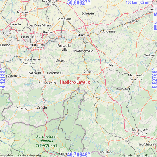
Hastière-Lavaux GPS coordinates[2]
50° 13' 6.564" North, 4° 49' 28.056" East
| Map corner | latitude | longitude |
|---|---|---|
| Upper-left | 50.66627°, | 4.12133° |
| Center: | 50.21849°, | 4.82446° |
| Lower-right: | 49.76646°, | 5.52758° |
| Map W x H: | 100×100 km | = 62.1×62.1mi |
| max Lat: | 51.46791° ⇑91.3% North |
| Hastière-Lavaux: | 50.21849° |
| min Lat: | ⇓8.7% South 49.53771° |
| min Long | Hastière-Lavau | max Long |
| 2.59368° | 4.82446° | 6.25749° |
| W 59.2%⇐ | ⇒40.8% E |
Elevation
Elevation of Hastière-Lavaux is 129 m = 423 ft, and this is 29.5 m = 97 ft above average elevation for this country.
| Max E: |
582 m = 1909 ft | 28.7% |
| Hastière-Lavaux | 129 m 423 ft | |
| Avg. | 99.5 m = 326 ft | |
Min E: |
1 m = 3 ft | 71.3% |
See also: Belgium elevation on elevation.city.
Geographical zone
Hastière-Lavaux is located in North temperate zone (between Tropic of Cancer and the Arctic Circle). Distance of this North polar circle is 1817.4 km =1129.3 mi to North.| Distance of | km | miles | from Hastière-Lavaux |
|---|---|---|---|
| North Pole | 4423.3 | 2748.5 | to North |
| Arctic Circle | 1817.4 | 1129.3 | to North |
| Tropic Cancer | 2977.9 | 1850.4 | to South |
| Equator | 5583.8 | 3469.6 | to South |


Nearby cities:
15 places around Hastière-Lavaux: (largest is in red/bold)
• Anhée
10.9 km =6.8 mi,  20°
20°
• Assesse
21.9 km =13.6 mi,  39°
39°
• Beauraing
15.2 km =9.4 mi,  142°
142°
• Ciney
21.3 km =13.2 mi,  66°
66°
• Dinant
7.6 km =4.7 mi,  54°
54°
• Doische
11.4 km =7.1 mi,  213°
213°
• Floreffe
24.5 km =15.2 mi,  349°
349°
• Florennes
15.9 km =9.9 mi,  283°
283°
• Fosses-la-Ville
21.7 km =13.5 mi,  335°
335°
• Houyet
13.5 km =8.4 mi,  105°
105°
• Mettet
16.2 km =10.1 mi,  314°
314°
• Onhaye
2.8 km =1.7 mi, 24°
• Philippeville
20.1 km =12.5 mi,  262°
262°
• Profondeville
17.7 km =11 mi,  9°
9°
• Yvoir
12.8 km =8 mi, 18°
Sources, notices
• [Note1] Compared only with cities in Belgium existing in our database
• [Src1] Map data: © OpenStreetMap contributors (CC-BY-SA)
• [Src2] Other city data from geonames.org with taken over terms of usage.
• [Src3] Geographical zone / Annual Mean Temperature by Robert A. Rohde @ Wikipedia
