Stara Kresna geodata
Stara Kresna (Blagoevgrad) is a populated place; located in Bulgaria in Europe/Sofia (GMT+3) time zone. With population of 3,586 people, there are 173 cities with bigger population in this country. Compared to other cities in Bulgaria, 90% of cities are located further ↑North; 86.7% of cities are located further →East and 82% of cities have lower elevation than Stara Kresna. Note1


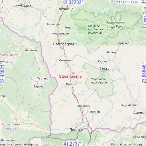
Stara Kresna GPS coordinates[2]
41° 48' 0" North, 23° 10' 59.988" East
| Map corner | latitude | longitude |
|---|---|---|
| Upper-left | 42.32202°, | 22.48021° |
| Center: | 41.8°, | 23.18333° |
| Lower-right: | 41.2737°, | 23.88646° |
| Map W x H: | 116.6×116.6 km | = 72.5×72.5mi |
| max Lat: | 44.16214° ⇑90% North |
| Stara Kresna: | 41.8° |
| min Lat: | ⇓10% South 41.32715° |
| min Long | Stara Kresna | max Long |
| 22.52139° | 23.18333° | 28.53429° |
| W 13.3%⇐ | ⇒86.7% E |
Elevation
Elevation of Stara Kresna is 561 m = 1841 ft, and this is 244.4 m = 802 ft above average elevation for this country.
| Max E: |
1221 m = 4006 ft | 18% |
| Stara Kresna | 561 m 1841 ft | |
| Avg. | 316.6 m = 1039 ft | |
Min E: |
1 m = 3 ft | 82% |
See also: Bulgaria elevation on elevation.city.
Geographical zone
Stara Kresna is located in North temperate zone (between Tropic of Cancer and the Arctic Circle). Distance of this Northern Tropic circle is 2041.8 km =1268.7 mi to South.| Distance of | km | miles | from Stara Kresna |
|---|---|---|---|
| North Pole | 5359.3 | 3330.1 | to North |
| Arctic Circle | 2753.4 | 1710.9 | to North |
| Tropic Cancer | 2041.8 | 1268.7 | to South |
| Equator | 4647.7 | 2887.9 | to South |


Nearby cities:
15 places around Stara Kresna: (largest is in red/bold)
• Bansko
25.6 km =15.9 mi,  80°
80°
• Belitsa
36.6 km =22.7 mi,  61°
61°
• Blagoevgrad
25.1 km =15.6 mi,  344°
344°
• Boboshevo
42 km =26.1 mi, 339°
• Borovets
36.6 km =22.7 mi, 338°
• Kocherinovo
33.3 km =20.7 mi, 341°
• Kresna
7.9 km =4.9 mi,  200°
200°
• Petrich
44.7 km =27.8 mi,  177°
177°
• Porominovo
31.8 km =19.8 mi,  345°
345°
• Razlog
25.4 km =15.8 mi,  67°
67°
• Rila
37.3 km =23.2 mi, 353°
• Sandanski
27.2 km =16.9 mi,  162°
162°
• Simitli
10.8 km =6.7 mi,  329°
329°
• Strumyani
18.6 km =11.6 mi, 175°
• Yakoruda
48.4 km =30.1 mi, 58°
Sources, notices
• [Note1] Compared only with cities in Bulgaria existing in our database
• [Src1] Map data: © OpenStreetMap contributors (CC-BY-SA)
• [Src2] Other city data from geonames.org with taken over terms of usage.
• [Src3] Geographical zone / Annual Mean Temperature by Robert A. Rohde @ Wikipedia
