Villazón geodata
Villazón (Potosí) is a populated place; located in Bolivia in America/La_Paz (GMT-4) time zone. With population of 30,253 people, there are 17 cities with bigger population in this country. Compared to other cities in Bolivia, 99.4% of cities are located further ↑North; 61.5% of cities are located further →East and 79.5% of cities have lower elevation than Villazón. Note1


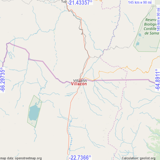
Villazón GPS coordinates[2]
22° 5' 11.724" South, 65° 35' 39.192" West
| Map corner | latitude | longitude |
|---|---|---|
| Upper-left | -21.43357°, | -66.29735° |
| Center: | -22.08659°, | -65.59422° |
| Lower-right: | -22.7366°, | -64.8911° |
| Map W x H: | 144.9×144.9 km | = 90×90mi |
| max Lat: | -9.71828° ⇑99.4% North |
| Villazón: | -22.08659° |
| min Lat: | ⇓0.6% South -22.73206° |
| min Long | Villazón | max Long |
| -69.14843° | -65.59422° | -57.76667° |
| W 38.5%⇐ | ⇒61.5% E |
Elevation
Elevation of Villazón is 3455 m = 11335 ft, and this is 1443.7 m = 4737 ft above average elevation for this country.
| Max E: |
4732 m = 15525 ft | 20.5% |
| Villazón | 3455 m 11335 ft | |
| Avg. | 2011.3 m = 6599 ft | |
Min E: |
92 m = 302 ft | 79.5% |
See also: Bolivia elevation on elevation.city.
Geographical zone
Villazón is located in South Torrid zone (between Equator and Tropic of Capricorn). Distance of this Southern Tropic circle is 150.1 km =93.3 mi to South.| Distance of | km | miles | from Villazón |
|---|---|---|---|
| Equator | 2455.8 | 1526 | to North |
| Tropic Capricorn | 150.1 | 93.3 | to South |
| Antarctic Circle | 4945.4 | 3072.9 | to South |
| South Pole | 7551.3 | 4692.2 | to South |


Nearby cities:
15 places around Villazón: (largest is in red/bold)
• Atocha
143.5 km =89.2 mi,  333°
333°
• Bermejo
147.8 km =91.8 mi,  119°
119°
• Camargo
165.7 km =103 mi,  13°
13°
• Culpina
155.7 km =96.7 mi,  25°
25°
• Entre Ríos
159.4 km =99 mi,  67°
67°
• La Cueva
147 km =91.3 mi, 29°
• Las Carreras
98.4 km =61.1 mi,  19°
19°
• Las Carreras
105.4 km =65.5 mi, 22°
• Lintaca
149.2 km =92.7 mi, 10°
• Pilaya
153.6 km =95.4 mi, 34°
• Salitre
151 km =93.8 mi, 27°
• San Juan
96.1 km =59.7 mi, 18°
• Santa Bárbara
138.4 km =86 mi,  340°
340°
• Tarija
108.3 km =67.3 mi,  55°
55°
• Tupiza
72.7 km =45.2 mi,  349°
349°
Sources, notices
• [Note1] Compared only with cities in Bolivia existing in our database
• [Src1] Map data: © OpenStreetMap contributors (CC-BY-SA)
• [Src2] Other city data from geonames.org with taken over terms of usage.
• [Src3] Geographical zone / Annual Mean Temperature by Robert A. Rohde @ Wikipedia
