Samaipata geodata
Samaipata (Santa Cruz) is a populated place; located in Bolivia in America/La_Paz (GMT-4) time zone. With population of 3,500 people, there are 77 cities with bigger population in this country. Compared to other cities in Bolivia, 56.5% of cities are located further ↑North; 72.7% of cities are located further ←West and 59% of cities have higher elevation than Samaipata. Note1


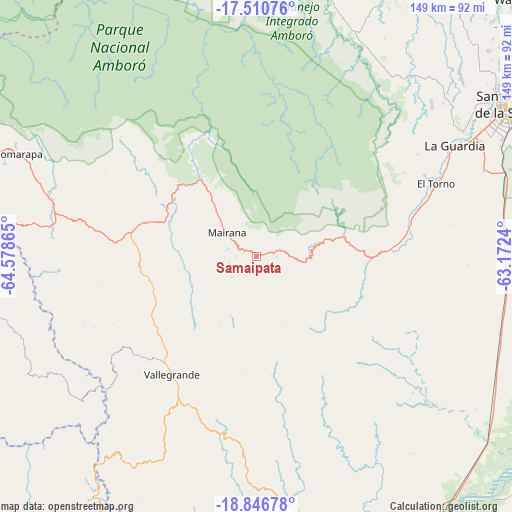
Samaipata GPS coordinates[2]
18° 10' 48.18" South, 63° 52' 31.872" West
| Map corner | latitude | longitude |
|---|---|---|
| Upper-left | -17.51076°, | -64.57865° |
| Center: | -18.18005°, | -63.87552° |
| Lower-right: | -18.84678°, | -63.1724° |
| Map W x H: | 148.6×148.6 km | = 92.3×92.3mi |
| max Lat: | -9.71828° ⇑56.5% North |
| Samaipata: | -18.18005° |
| min Lat: | ⇓43.5% South -22.73206° |
| min Long | Samaipata | max Long |
| -69.14843° | -63.87552° | -57.76667° |
| W 72.7%⇐ | ⇒27.3% E |
Elevation
Elevation of Samaipata is 1647 m = 5404 ft, and this is 364.3 m = 1195 ft below average elevation for this country.
| Max E: |
4732 m = 15525 ft | 59% |
| Avg. | 2011.3 m = 6599 ft | |
| Samaipata | 1647 m = 5404 ft | |
Min E: |
92 m = 302 ft | 41% |
See also: Bolivia elevation on elevation.city.
Geographical zone
Samaipata is located in South Torrid zone (between Equator and Tropic of Capricorn). Distance of this Southern Tropic circle is 584.5 km =363.2 mi to South.| Distance of | km | miles | from Samaipata |
|---|---|---|---|
| Equator | 2021.4 | 1256 | to North |
| Tropic Capricorn | 584.5 | 363.2 | to South |
| Antarctic Circle | 5379.7 | 3342.8 | to South |
| South Pole | 7985.6 | 4962 | to South |


Nearby cities:
15 places around Samaipata: (largest is in red/bold)
• Abapó
94 km =58.4 mi,  146°
146°
• Buena Vista
83.1 km =51.6 mi,  15°
15°
• Comarapa
75.3 km =46.8 mi,  292°
292°
• Jorochito
49.3 km =30.6 mi,  73°
73°
• Limoncito
52.4 km =32.6 mi, 71°
• Los Negros
68.2 km =42.4 mi,  43°
43°
• Mairana
11.2 km =7 mi,  307°
307°
• San Carlos
87.7 km =54.5 mi,  8°
8°
• San Juan del Surutú
79.7 km =49.5 mi, 13°
• Santa Cruz de la Sierra
85.5 km =53.1 mi,  59°
59°
• Santa Fe
93.4 km =58 mi, 71°
• Santa Rita
60.4 km =37.5 mi, 66°
• Santiago del Torno
56.5 km =35.1 mi, 67°
• Vallegrande
42.1 km =26.2 mi,  215°
215°
• Villa Yapacaní
86.8 km =53.9 mi,  2°
2°
Sources, notices
• [Note1] Compared only with cities in Bolivia existing in our database
• [Src1] Map data: © OpenStreetMap contributors (CC-BY-SA)
• [Src2] Other city data from geonames.org with taken over terms of usage.
• [Src3] Geographical zone / Annual Mean Temperature by Robert A. Rohde @ Wikipedia
