Entre Ríos geodata
Entre Ríos (Tarija) is a populated place; located in Bolivia in America/La_Paz (GMT-4) time zone. With population of 2,685 people, there are 89 cities with bigger population in this country. Compared to other cities in Bolivia, 97.5% of cities are located further ↑North; 69.6% of cities are located further ←West and 61.5% of cities have higher elevation than Entre Ríos. Note1


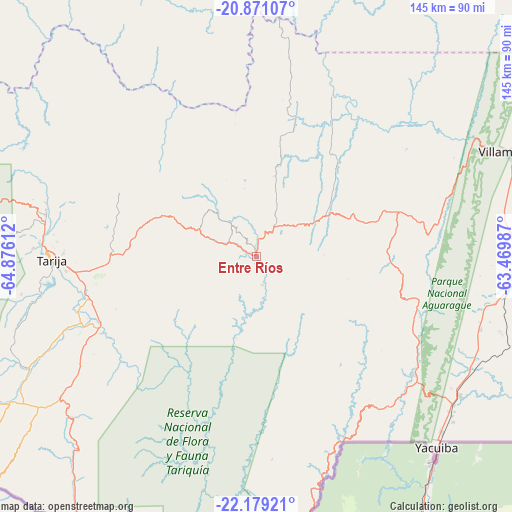
Entre Ríos GPS coordinates[2]
21° 31' 35.796" South, 64° 10' 22.764" West
| Map corner | latitude | longitude |
|---|---|---|
| Upper-left | -20.87107°, | -64.87612° |
| Center: | -21.52661°, | -64.17299° |
| Lower-right: | -22.17921°, | -63.46987° |
| Map W x H: | 145.5×145.5 km | = 90.4×90.4mi |
| max Lat: | -9.71828° ⇑97.5% North |
| Entre Ríos: | -21.52661° |
| min Lat: | ⇓2.5% South -22.73206° |
| min Long | Entre Ríos | max Long |
| -69.14843° | -64.17299° | -57.76667° |
| W 69.6%⇐ | ⇒30.4% E |
Elevation
Elevation of Entre Ríos is 1232 m = 4042 ft, and this is 779.3 m = 2557 ft below average elevation for this country.
| Max E: |
4732 m = 15525 ft | 61.5% |
| Avg. | 2011.3 m = 6599 ft | |
| Entre Ríos | 1232 m = 4042 ft | |
Min E: |
92 m = 302 ft | 38.5% |
See also: Bolivia elevation on elevation.city.
Geographical zone
Entre Ríos is located in South Torrid zone (between Equator and Tropic of Capricorn). Distance of this Southern Tropic circle is 212.4 km =132 mi to South.| Distance of | km | miles | from Entre Ríos |
|---|---|---|---|
| Equator | 2393.5 | 1487.3 | to North |
| Tropic Capricorn | 212.4 | 132 | to South |
| Antarctic Circle | 5007.6 | 3111.6 | to South |
| South Pole | 7613.5 | 4730.8 | to South |


Nearby cities:
15 places around Entre Ríos: (largest is in red/bold)
• Camatindi
97.6 km =60.6 mi,  51°
51°
• Culpina
111.9 km =69.5 mi,  314°
314°
• Huajlaya
110.2 km =68.5 mi,  339°
339°
• La Cueva
100.1 km =62.2 mi, 311°
• Las Carreras
113 km =70.2 mi,  288°
288°
• Las Carreras
119 km =73.9 mi,  284°
284°
• Pilaya
87.7 km =54.5 mi,  316°
316°
• Rosario del Ingre
108.6 km =67.5 mi,  15°
15°
• Salitre
105.2 km =65.4 mi, 312°
• San Francisco
105.3 km =65.4 mi,  328°
328°
• San Juan
120.2 km =74.7 mi, 283°
• Tarija
57.6 km =35.8 mi,  269°
269°
• Villa Charcas
115.9 km =72 mi, 320°
• Villamontes
78.6 km =48.8 mi,  68°
68°
• Yacuiba
74.7 km =46.4 mi,  136°
136°
Sources, notices
• [Note1] Compared only with cities in Bolivia existing in our database
• [Src1] Map data: © OpenStreetMap contributors (CC-BY-SA)
• [Src2] Other city data from geonames.org with taken over terms of usage.
• [Src3] Geographical zone / Annual Mean Temperature by Robert A. Rohde @ Wikipedia
