Villamontes geodata
Villamontes (Tarija) is a populated place; located in Bolivia in America/La_Paz (GMT-4) time zone. With population of 18,761 people, there are 27 cities with bigger population in this country. Compared to other cities in Bolivia, 95.7% of cities are located further ↑North; 78.3% of cities are located further ←West and 74.5% of cities have higher elevation than Villamontes. Note1


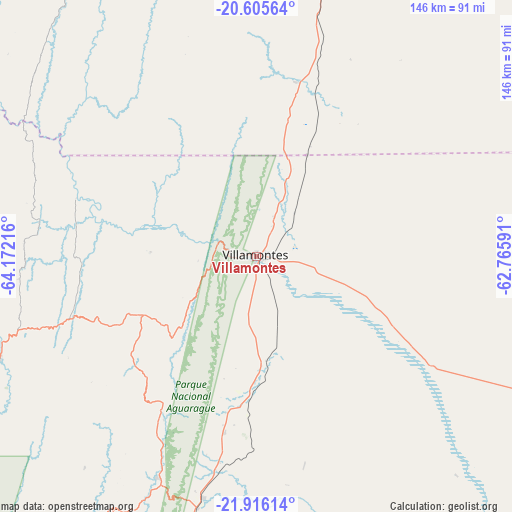
Villamontes GPS coordinates[2]
21° 15' 44.46" South, 63° 28' 8.508" West
| Map corner | latitude | longitude |
|---|---|---|
| Upper-left | -20.60564°, | -64.17216° |
| Center: | -21.26235°, | -63.46903° |
| Lower-right: | -21.91614°, | -62.76591° |
| Map W x H: | 145.7×145.7 km | = 90.5×90.5mi |
| max Lat: | -9.71828° ⇑95.7% North |
| Villamontes: | -21.26235° |
| min Lat: | ⇓4.3% South -22.73206° |
| min Long | Villamontes | max Long |
| -69.14843° | -63.46903° | -57.76667° |
| W 78.3%⇐ | ⇒21.7% E |
Elevation
Elevation of Villamontes is 388 m = 1273 ft, and this is 1623.3 m = 5326 ft below average elevation for this country.
| Max E: |
4732 m = 15525 ft | 74.5% |
| Avg. | 2011.3 m = 6599 ft | |
| Villamontes | 388 m = 1273 ft | |
Min E: |
92 m = 302 ft | 25.5% |
See also: Bolivia elevation on elevation.city.
Geographical zone
Villamontes is located in South Torrid zone (between Equator and Tropic of Capricorn). Distance of this Southern Tropic circle is 241.8 km =150.2 mi to South.| Distance of | km | miles | from Villamontes |
|---|---|---|---|
| Equator | 2364.2 | 1469 | to North |
| Tropic Capricorn | 241.8 | 150.2 | to South |
| Antarctic Circle | 5037 | 3129.8 | to South |
| South Pole | 7642.9 | 4749.1 | to South |


Nearby cities:
15 places around Villamontes: (largest is in red/bold)
• Boyuibe
94.3 km =58.6 mi,  11°
11°
• Camatindi
31.2 km =19.4 mi, 6°
• Camiri
136.2 km =84.6 mi,  357°
357°
• Carandayti
70.6 km =43.9 mi,  36°
36°
• Entre Ríos
78.6 km =48.8 mi,  248°
248°
• Huajlaya
134.3 km =83.5 mi,  303°
303°
• La Cueva
152.9 km =95 mi,  283°
283°
• Pilaya
137.3 km =85.3 mi, 284°
• Rosario del Ingre
87.8 km =54.6 mi,  329°
329°
• Salitre
156 km =96.9 mi,  285°
285°
• San Francisco
141.5 km =87.9 mi, 295°
• Santa Elena
157.8 km =98.1 mi, 300°
• Sapirangui
151.4 km =94.1 mi,  347°
347°
• Tarija
134 km =83.3 mi,  256°
256°
• Yacuiba
86.6 km =53.8 mi,  194°
194°
Sources, notices
• [Note1] Compared only with cities in Bolivia existing in our database
• [Src1] Map data: © OpenStreetMap contributors (CC-BY-SA)
• [Src2] Other city data from geonames.org with taken over terms of usage.
• [Src3] Geographical zone / Annual Mean Temperature by Robert A. Rohde @ Wikipedia
