Monte Alegre geodata
Monte Alegre (Pará) is a populated place; located in Brazil in America/Santarem (GMT-3) time zone. With population of 22,840 people, there are 836 cities with bigger population in this country. Compared to other cities in Brazil, 97.3% of cities are located further ↓South; 92.7% of cities are located further →East and 77.9% of cities have higher elevation than Monte Alegre. Note1


Monte Alegre GPS coordinates[2]
2° 0' 2.952" South, 54° 4' 51.672" West
| Map corner | latitude | longitude |
|---|---|---|
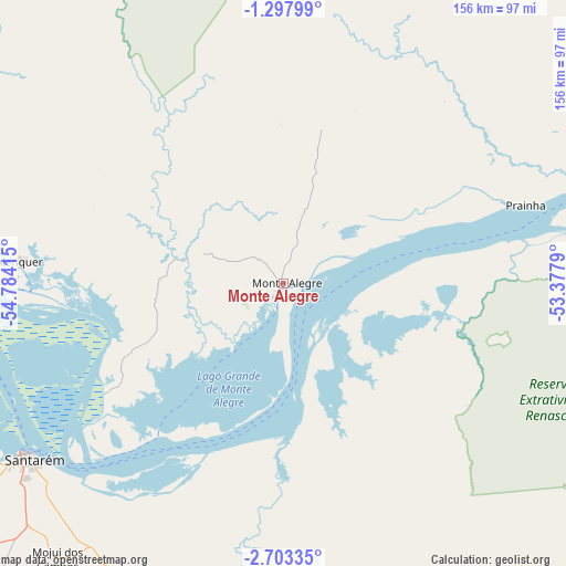
| Upper-left | -1.29799°, | -54.78415° |
| Center: | -2.00082°, | -54.08102° |
| Lower-right: | -2.70335°, | -53.3779° |
| Map W x H: | 156.3×156.3 km | = 97.1×97.1mi |
| max Lat: | 2.81972° ⇑2.7% North |
| Monte Alegre: | -2.00082° |
| min Lat: | ⇓97.3% South -33.69111° |
| min Long | Monte Alegre | max Long |
| -72.89583° | -54.08102° | -32.41083° |
| W 7.3%⇐ | ⇒92.7% E |
Elevation
Elevation of Monte Alegre is 57 m = 187 ft, and this is 323.9 m = 1063 ft below average elevation for this country.
| Max E: |
1603 m = 5259 ft | 77.9% |
| Avg. | 380.9 m = 1250 ft | |
| Monte Alegre | 57 m = 187 ft | |
Min E: |
0 m = 0 ft | 22.1% |
See also: Brazil elevation on elevation.city.
Geographical zone
Monte Alegre is located in South Torrid zone (between Equator and Tropic of Capricorn). Distance of Equator is 222.5 km =138.3 mi to North.| Distance of | km | miles | from Monte Alegre |
|---|---|---|---|
| Equator | 222.5 | 138.3 | to North |
| Tropic Capricorn | 2383.4 | 1481 | to South |
| Antarctic Circle | 7178.7 | 4460.6 | to South |
| South Pole | 9784.6 | 6079.9 | to South |


Nearby cities:
15 places around Monte Alegre: (largest is in red/bold)
• Alenquer
73.3 km =45.5 mi,  275°
275°
• Almeirim
174.9 km =108.7 mi,  72°
72°
• Altamira
247.5 km =153.8 mi,  122°
122°
• Gurupá
279.3 km =173.5 mi,  76°
76°
• Itaituba
329.6 km =204.8 mi,  219°
219°
• Juruti
224.1 km =139.2 mi,  265°
265°
• Nhamundá
293.2 km =182.2 mi, 265°
• Oriximiná
200.1 km =124.3 mi, 277°
• Parintins
303.1 km =188.3 mi,  256°
256°
• Porto de Moz
206.7 km =128.4 mi, 82°
• Prainha
70.4 km =43.7 mi, 71°
• Santarém
85.3 km =53 mi,  234°
234°
• Senador José Porfírio
245.2 km =152.4 mi,  105°
105°
• Terra Santa
267.6 km =166.3 mi, 267°
• Óbidos
160 km =99.4 mi, 273°
Sources, notices
• [Note1] Compared only with cities in Brazil existing in our database
• [Src1] Map data: © OpenStreetMap contributors (CC-BY-SA)
• [Src2] Other city data from geonames.org with taken over terms of usage.
• [Src3] Geographical zone / Annual Mean Temperature by Robert A. Rohde @ Wikipedia
