Monsenhor Gil geodata
Monsenhor Gil (Piauí) is a populated place; located in Brazil in America/Fortaleza (GMT-3) time zone. With population of 4,751 people, there are 1930 cities with bigger population in this country. Compared to other cities in Brazil, 86.9% of cities are located further ↓South; 63% of cities are located further ←West and 69.4% of cities have higher elevation than Monsenhor Gil. Note1


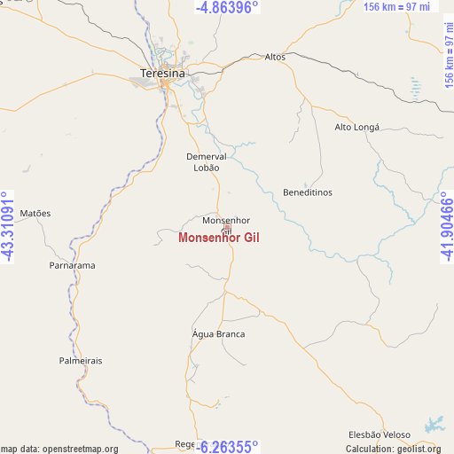
Monsenhor Gil GPS coordinates[2]
5° 33' 51.012" South, 42° 36' 28.008" West
| Map corner | latitude | longitude |
|---|---|---|
| Upper-left | -4.86396°, | -43.31091° |
| Center: | -5.56417°, | -42.60778° |
| Lower-right: | -6.26355°, | -41.90466° |
| Map W x H: | 155.6×155.6 km | = 96.7×96.7mi |
| max Lat: | 2.81972° ⇑13.1% North |
| Monsenhor Gil: | -5.56417° |
| min Lat: | ⇓86.9% South -33.69111° |
| min Long | Monsenhor Gil | max Long |
| -72.89583° | -42.60778° | -32.41083° |
| W 63%⇐ | ⇒37% E |
Elevation
Elevation of Monsenhor Gil is 129 m = 423 ft, and this is 251.9 m = 826 ft below average elevation for this country.
| Max E: |
1603 m = 5259 ft | 69.4% |
| Avg. | 380.9 m = 1250 ft | |
| Monsenhor Gil | 129 m = 423 ft | |
Min E: |
0 m = 0 ft | 30.6% |
See also: Brazil elevation on elevation.city.
Geographical zone
Monsenhor Gil is located in South Torrid zone (between Equator and Tropic of Capricorn). Distance of Equator is 618.7 km =384.4 mi to North.| Distance of | km | miles | from Monsenhor Gil |
|---|---|---|---|
| Equator | 618.7 | 384.4 | to North |
| Tropic Capricorn | 1987.2 | 1234.8 | to South |
| Antarctic Circle | 6782.5 | 4214.4 | to South |
| South Pole | 9388.4 | 5833.7 | to South |


Nearby cities:
15 places around Monsenhor Gil: (largest is in red/bold)
• Alto Longá
56.1 km =34.9 mi,  51°
51°
• Altos
60.7 km =37.7 mi,  15°
15°
• Amarante
79.9 km =49.6 mi,  199°
199°
• Beneditinos
29.6 km =18.4 mi,  64°
64°
• Demerval Lobão
24.1 km =15 mi,  341°
341°
• Elesbão Veloso
87.8 km =54.6 mi,  143°
143°
• Estreito
75.1 km =46.7 mi,  251°
251°
• José de Freitas
89.9 km =55.9 mi,  2°
2°
• Palmeirais
68.2 km =42.4 mi,  227°
227°
• Parnarama
55.3 km =34.4 mi,  256°
256°
• Regeneração
74.7 km =46.4 mi,  186°
186°
• São Pedro do Piauí
42.4 km =26.3 mi, 196°
• Teresina
57 km =35.4 mi, 337°
• Timon
58.1 km =36.1 mi,  334°
334°
• Água Branca
36.6 km =22.7 mi,  184°
184°
Sources, notices
• [Note1] Compared only with cities in Brazil existing in our database
• [Src1] Map data: © OpenStreetMap contributors (CC-BY-SA)
• [Src2] Other city data from geonames.org with taken over terms of usage.
• [Src3] Geographical zone / Annual Mean Temperature by Robert A. Rohde @ Wikipedia
