Jaguaribe geodata
Jaguaribe (Ceará) is a populated place; located in Brazil in America/Fortaleza (GMT-3) time zone. With population of 23,065 people, there are 829 cities with bigger population in this country. Compared to other cities in Brazil, 85.7% of cities are located further ↓South; 81.9% of cities are located further ←West and 69.7% of cities have higher elevation than Jaguaribe. Note1


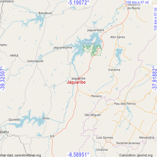
Jaguaribe GPS coordinates[2]
5° 53' 26.016" South, 38° 37' 18.984" West
| Map corner | latitude | longitude |
|---|---|---|
| Upper-left | -5.19072°, | -39.32507° |
| Center: | -5.89056°, | -38.62194° |
| Lower-right: | -6.58951°, | -37.91882° |
| Map W x H: | 155.5×155.5 km | = 96.6×96.6mi |
| max Lat: | 2.81972° ⇑14.3% North |
| Jaguaribe: | -5.89056° |
| min Lat: | ⇓85.7% South -33.69111° |
| min Long | Jaguaribe | max Long |
| -72.89583° | -38.62194° | -32.41083° |
| W 81.9%⇐ | ⇒18.1% E |
Elevation
Elevation of Jaguaribe is 127 m = 417 ft, and this is 253.9 m = 833 ft below average elevation for this country.
| Max E: |
1603 m = 5259 ft | 69.7% |
| Avg. | 380.9 m = 1250 ft | |
| Jaguaribe | 127 m = 417 ft | |
Min E: |
0 m = 0 ft | 30.3% |
See also: Brazil elevation on elevation.city.
Geographical zone
Jaguaribe is located in South Torrid zone (between Equator and Tropic of Capricorn). Distance of Equator is 655 km =407 mi to North.| Distance of | km | miles | from Jaguaribe |
|---|---|---|---|
| Equator | 655 | 407 | to North |
| Tropic Capricorn | 1951 | 1212.3 | to South |
| Antarctic Circle | 6746.2 | 4191.9 | to South |
| South Pole | 9352.1 | 5811.1 | to South |


Nearby cities:
15 places around Jaguaribe: (largest is in red/bold)
• Acopiara
94.6 km =58.8 mi,  256°
256°
• Alexandria
88.6 km =55.1 mi,  130°
130°
• Apodi
94.5 km =58.7 mi,  74°
74°
• Barro
95.8 km =59.5 mi,  196°
196°
• Cedro
93.3 km =58 mi,  211°
211°
• Icó
62.7 km =39 mi, 205°
• Iguatu
91.2 km =56.7 mi,  235°
235°
• Morada Nova
91.4 km =56.8 mi,  17°
17°
• Orós
50.9 km =31.6 mi,  219°
219°
• Senador Pompeu
89.5 km =55.6 mi,  292°
292°
• Serra Branca
81.5 km =50.6 mi,  151°
151°
• Severiano Melo
74.5 km =46.3 mi,  80°
80°
• Triunfo
75.2 km =46.7 mi,  178°
178°
• Uiraúna
73.6 km =45.7 mi,  161°
161°
• Umarizal
90 km =55.9 mi,  97°
97°
Sources, notices
• [Note1] Compared only with cities in Brazil existing in our database
• [Src1] Map data: © OpenStreetMap contributors (CC-BY-SA)
• [Src2] Other city data from geonames.org with taken over terms of usage.
• [Src3] Geographical zone / Annual Mean Temperature by Robert A. Rohde @ Wikipedia
