Três Barras geodata
Três Barras (Santa Catarina) is a populated place; located in Brazil in America/Sao_Paulo (GMT-3) time zone. With population of 14,855 people, there are 1223 cities with bigger population in this country. Compared to other cities in Brazil, 89.7% of cities are located further ↑North; 79.5% of cities are located further →East and 86% of cities have lower elevation than Três Barras. Note1


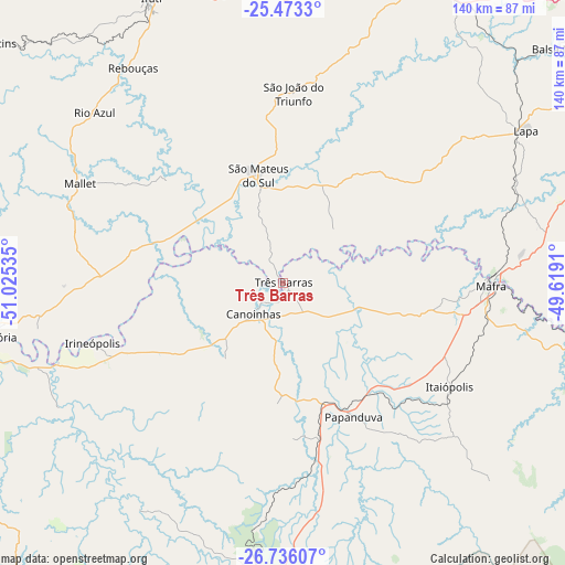
Três Barras GPS coordinates[2]
26° 6' 23.004" South, 50° 19' 19.992" West
| Map corner | latitude | longitude |
|---|---|---|
| Upper-left | -25.4733°, | -51.02535° |
| Center: | -26.10639°, | -50.32222° |
| Lower-right: | -26.73607°, | -49.6191° |
| Map W x H: | 140.4×140.4 km | = 87.2×87.2mi |
| max Lat: | 2.81972° ⇑89.7% North |
| Três Barras: | -26.10639° |
| min Lat: | ⇓10.3% South -33.69111° |
| min Long | Três Barras | max Long |
| -72.89583° | -50.32222° | -32.41083° |
| W 20.5%⇐ | ⇒79.5% E |
Elevation
Elevation of Três Barras is 767 m = 2516 ft, and this is 386.1 m = 1267 ft above average elevation for this country.
| Max E: |
1603 m = 5259 ft | 14% |
| Três Barras | 767 m 2516 ft | |
| Avg. | 380.9 m = 1250 ft | |
Min E: |
0 m = 0 ft | 86% |
See also: Brazil elevation on elevation.city.
Geographical zone
Três Barras is located in South temperate zone (between Tropic of Capricorn and the Antarctic Circle). Distance of this Southern Tropic circle is 296.8 km =184.4 mi to North.| Distance of | km | miles | from Três Barras |
|---|---|---|---|
| Equator | 2902.8 | 1803.7 | to North |
| Tropic Capricorn | 296.8 | 184.4 | to North |
| Antarctic Circle | 4498.4 | 2795.2 | to South |
| South Pole | 7104.3 | 4414.4 | to South |


Nearby cities:
15 places around Três Barras: (largest is in red/bold)
• Campo Largo
107.1 km =66.5 mi,  47°
47°
• Canoinhas
10.4 km =6.5 mi,  220°
220°
• Caçador
101.4 km =63 mi, 222°
• Imbituva
101.5 km =63.1 mi,  343°
343°
• Irati
78.3 km =48.7 mi, 335°
• Lapa
71.3 km =44.3 mi,  58°
58°
• Mafra
51.6 km =32.1 mi,  90°
90°
• Palmeira
81.6 km =50.7 mi,  22°
22°
• Porto União
76.9 km =47.8 mi,  259°
259°
• Rio Negrinho
81.9 km =50.9 mi,  101°
101°
• Rio Negro
52.4 km =32.6 mi, 89°
• Santa Cecília
95.6 km =59.4 mi,  186°
186°
• São Bento do Sul
95.5 km =59.3 mi, 99°
• São Mateus do Sul
26.5 km =16.5 mi,  346°
346°
• União da Vitória
77.5 km =48.2 mi, 259°
Sources, notices
• [Note1] Compared only with cities in Brazil existing in our database
• [Src1] Map data: © OpenStreetMap contributors (CC-BY-SA)
• [Src2] Other city data from geonames.org with taken over terms of usage.
• [Src3] Geographical zone / Annual Mean Temperature by Robert A. Rohde @ Wikipedia
