Canoinhas geodata
Canoinhas (Santa Catarina) is a populated place; located in Brazil in America/Sao_Paulo (GMT-3) time zone. With population of 38,862 people, there are 539 cities with bigger population in this country. Compared to other cities in Brazil, 89.8% of cities are located further ↑North; 80% of cities are located further →East and 87.6% of cities have lower elevation than Canoinhas. Note1


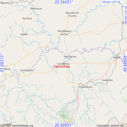
Canoinhas GPS coordinates[2]
26° 10' 37.992" South, 50° 23' 24" West
| Map corner | latitude | longitude |
|---|---|---|
| Upper-left | -25.54451°, | -51.09313° |
| Center: | -26.17722°, | -50.39° |
| Lower-right: | -26.80651°, | -49.68688° |
| Map W x H: | 140.3×140.3 km | = 87.2×87.2mi |
| max Lat: | 2.81972° ⇑89.8% North |
| Canoinhas: | -26.17722° |
| min Lat: | ⇓10.2% South -33.69111° |
| min Long | Canoinhas | max Long |
| -72.89583° | -50.39° | -32.41083° |
| W 20%⇐ | ⇒80% E |
Elevation
Elevation of Canoinhas is 779 m = 2556 ft, and this is 398.1 m = 1306 ft above average elevation for this country.
| Max E: |
1603 m = 5259 ft | 12.4% |
| Canoinhas | 779 m 2556 ft | |
| Avg. | 380.9 m = 1250 ft | |
Min E: |
0 m = 0 ft | 87.6% |
See also: Brazil elevation on elevation.city.
Geographical zone
Canoinhas is located in South temperate zone (between Tropic of Capricorn and the Antarctic Circle). Distance of this Southern Tropic circle is 304.7 km =189.3 mi to North.| Distance of | km | miles | from Canoinhas |
|---|---|---|---|
| Equator | 2910.6 | 1808.6 | to North |
| Tropic Capricorn | 304.7 | 189.3 | to North |
| Antarctic Circle | 4490.5 | 2790.3 | to South |
| South Pole | 7096.4 | 4409.5 | to South |


Nearby cities:
15 places around Canoinhas: (largest is in red/bold)
• Campo Largo
117.4 km =72.9 mi,  47°
47°
• Caçador
91.1 km =56.6 mi,  223°
223°
• Imbituva
107.5 km =66.8 mi,  348°
348°
• Irati
83.2 km =51.7 mi,  341°
341°
• Lapa
81.2 km =50.5 mi,  56°
56°
• Mafra
58.8 km =36.5 mi,  82°
82°
• Palmeira
91.6 km =56.9 mi,  24°
24°
• Porto União
69 km =42.9 mi,  264°
264°
• Rio Negrinho
87.4 km =54.3 mi,  95°
95°
• Rio Negro
59.7 km =37.1 mi, 82°
• Santa Cecília
87.2 km =54.2 mi,  182°
182°
• São Bento do Sul
101.2 km =62.9 mi,  94°
94°
• São Mateus do Sul
33.7 km =20.9 mi,  1°
1°
• Três Barras
10.4 km =6.5 mi,  40°
40°
• União da Vitória
69.7 km =43.3 mi,  265°
265°
Sources, notices
• [Note1] Compared only with cities in Brazil existing in our database
• [Src1] Map data: © OpenStreetMap contributors (CC-BY-SA)
• [Src2] Other city data from geonames.org with taken over terms of usage.
• [Src3] Geographical zone / Annual Mean Temperature by Robert A. Rohde @ Wikipedia
