Pirenópolis geodata
Pirenópolis (Goiás) is a populated place; located in Brazil in America/Sao_Paulo (GMT-3) time zone. With population of 13,615 people, there are 1319 cities with bigger population in this country. Compared to other cities in Brazil, 53.9% of cities are located further ↓South; 71.3% of cities are located further →East and 84.3% of cities have lower elevation than Pirenópolis. Note1


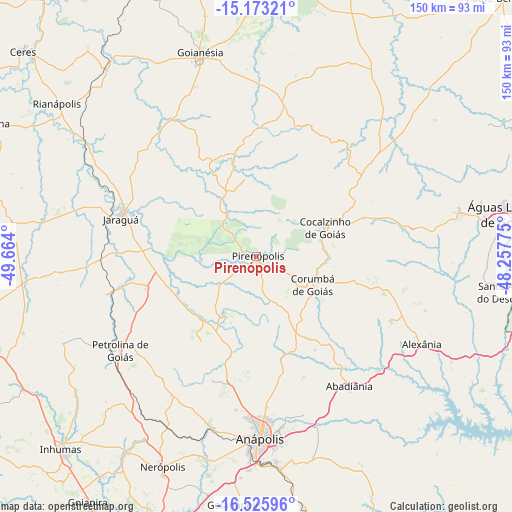
Pirenópolis GPS coordinates[2]
15° 51' 2.592" South, 48° 57' 39.132" West
| Map corner | latitude | longitude |
|---|---|---|
| Upper-left | -15.17321°, | -49.664° |
| Center: | -15.85072°, | -48.96087° |
| Lower-right: | -16.52596°, | -48.25775° |
| Map W x H: | 150.4×150.4 km | = 93.5×93.5mi |
| max Lat: | 2.81972° ⇑46.1% North |
| Pirenópolis: | -15.85072° |
| min Lat: | ⇓53.9% South -33.69111° |
| min Long | Pirenópolis | max Long |
| -72.89583° | -48.96087° | -32.41083° |
| W 28.7%⇐ | ⇒71.3% E |
Elevation
Elevation of Pirenópolis is 751 m = 2464 ft, and this is 370.1 m = 1214 ft above average elevation for this country.
| Max E: |
1603 m = 5259 ft | 15.7% |
| Pirenópolis | 751 m 2464 ft | |
| Avg. | 380.9 m = 1250 ft | |
Min E: |
0 m = 0 ft | 84.3% |
See also: Brazil elevation on elevation.city.
Geographical zone
Pirenópolis is located in South Torrid zone (between Equator and Tropic of Capricorn). Distance of this Southern Tropic circle is 843.5 km =524.1 mi to South.| Distance of | km | miles | from Pirenópolis |
|---|---|---|---|
| Equator | 1762.4 | 1095.1 | to North |
| Tropic Capricorn | 843.5 | 524.1 | to South |
| Antarctic Circle | 5638.7 | 3503.7 | to South |
| South Pole | 8244.6 | 5123 | to South |


Nearby cities:
15 places around Pirenópolis: (largest is in red/bold)
• Abadiânia
47.8 km =29.7 mi,  145°
145°
• Anápolis
52.9 km =32.9 mi,  179°
179°
• Ceres
91.1 km =56.6 mi,  311°
311°
• Goianira
87.3 km =54.2 mi,  214°
214°
• Goianápolis
73.7 km =45.8 mi,  185°
185°
• Goianésia
61.6 km =38.3 mi,  344°
344°
• Goiânia
97.2 km =60.4 mi,  198°
198°
• Inhumas
80.3 km =49.9 mi,  225°
225°
• Itaberaí
92.8 km =57.7 mi,  258°
258°
• Jaraguá
41.3 km =25.7 mi,  284°
284°
• Nerópolis
67.6 km =42 mi, 204°
• Petrolina de Goiás
48.6 km =30.2 mi,  236°
236°
• Rialma
89.5 km =55.6 mi, 311°
• Senador Canedo
96.4 km =59.9 mi, 188°
• Uruana
86.4 km =53.7 mi,  296°
296°
Sources, notices
• [Note1] Compared only with cities in Brazil existing in our database
• [Src1] Map data: © OpenStreetMap contributors (CC-BY-SA)
• [Src2] Other city data from geonames.org with taken over terms of usage.
• [Src3] Geographical zone / Annual Mean Temperature by Robert A. Rohde @ Wikipedia
