Jaraguá geodata
Jaraguá (Goiás) is a populated place; located in Brazil in America/Sao_Paulo (GMT-3) time zone. With population of 30,409 people, there are 662 cities with bigger population in this country. Compared to other cities in Brazil, 54.2% of cities are located further ↓South; 74.3% of cities are located further →East and 77.1% of cities have lower elevation than Jaraguá. Note1


Jaraguá GPS coordinates[2]
15° 45' 24.984" South, 49° 20' 3.984" West
| Map corner | latitude | longitude |
|---|---|---|
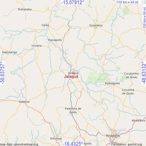
| Upper-left | -15.07912°, | -50.03757° |
| Center: | -15.75694°, | -49.33444° |
| Lower-right: | -16.4325°, | -48.63132° |
| Map W x H: | 150.5×150.5 km | = 93.5×93.5mi |
| max Lat: | 2.81972° ⇑45.8% North |
| Jaraguá: | -15.75694° |
| min Lat: | ⇓54.2% South -33.69111° |
| min Long | Jaraguá | max Long |
| -72.89583° | -49.33444° | -32.41083° |
| W 25.7%⇐ | ⇒74.3% E |
Elevation
Elevation of Jaraguá is 655 m = 2149 ft, and this is 274.1 m = 899 ft above average elevation for this country.
| Max E: |
1603 m = 5259 ft | 22.9% |
| Jaraguá | 655 m 2149 ft | |
| Avg. | 380.9 m = 1250 ft | |
Min E: |
0 m = 0 ft | 77.1% |
See also: Brazil elevation on elevation.city.
Geographical zone
Jaraguá is located in South Torrid zone (between Equator and Tropic of Capricorn). Distance of this Southern Tropic circle is 853.9 km =530.6 mi to South.| Distance of | km | miles | from Jaraguá |
|---|---|---|---|
| Equator | 1752 | 1088.6 | to North |
| Tropic Capricorn | 853.9 | 530.6 | to South |
| Antarctic Circle | 5649.2 | 3510.2 | to South |
| South Pole | 8255.1 | 5129.5 | to South |


Nearby cities:
15 places around Jaraguá: (largest is in red/bold)
• Abadiânia
83.5 km =51.9 mi,  126°
126°
• Anápolis
75.3 km =46.8 mi,  147°
147°
• Carmo do Rio Verde
60.1 km =37.3 mi,  318°
318°
• Ceres
57.3 km =35.6 mi,  330°
330°
• Goianira
82.8 km =51.4 mi,  186°
186°
• Goianésia
54.1 km =33.6 mi,  25°
25°
• Inhumas
69 km =42.9 mi, 194°
• Itaberaí
58.7 km =36.5 mi,  240°
240°
• Itapuranga
69.2 km =43 mi,  288°
288°
• Nerópolis
73.3 km =45.5 mi,  170°
170°
• Petrolina de Goiás
37.6 km =23.4 mi,  180°
180°
• Pirenópolis
41.3 km =25.7 mi,  104°
104°
• Rialma
56 km =34.8 mi, 331°
• Rubiataba
82.9 km =51.5 mi, 322°
• Uruana
46.7 km =29 mi,  307°
307°
Sources, notices
• [Note1] Compared only with cities in Brazil existing in our database
• [Src1] Map data: © OpenStreetMap contributors (CC-BY-SA)
• [Src2] Other city data from geonames.org with taken over terms of usage.
• [Src3] Geographical zone / Annual Mean Temperature by Robert A. Rohde @ Wikipedia
