Abadiânia geodata
Abadiânia (Goiás) is a populated place; located in Brazil in America/Sao_Paulo (GMT-3) time zone. With population of 7,062 people, there are 1826 cities with bigger population in this country. Compared to other cities in Brazil, 53.1% of cities are located further ↓South; 69.5% of cities are located further →East and 99.1% of cities have lower elevation than Abadiânia. Note1


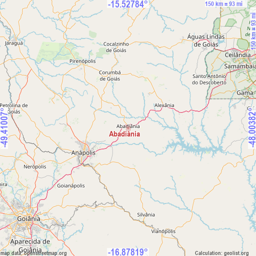
Abadiânia GPS coordinates[2]
16° 12' 15.012" South, 48° 42' 24.984" West
| Map corner | latitude | longitude |
|---|---|---|
| Upper-left | -15.52784°, | -49.41007° |
| Center: | -16.20417°, | -48.70694° |
| Lower-right: | -16.87819°, | -48.00382° |
| Map W x H: | 150.1×150.1 km | = 93.3×93.3mi |
| max Lat: | 2.81972° ⇑46.9% North |
| Abadiânia: | -16.20417° |
| min Lat: | ⇓53.1% South -33.69111° |
| min Long | Abadiânia | max Long |
| -72.89583° | -48.70694° | -32.41083° |
| W 30.5%⇐ | ⇒69.5% E |
Elevation
Elevation of Abadiânia is 1057 m = 3468 ft, and this is 676.1 m = 2218 ft above average elevation for this country.
| Max E: |
1603 m = 5259 ft | 0.90000000000001% |
| Abadiânia | 1057 m 3468 ft | |
| Avg. | 380.9 m = 1250 ft | |
Min E: |
0 m = 0 ft | 99.1% |
See also: Brazil elevation on elevation.city.
Geographical zone
Abadiânia is located in South Torrid zone (between Equator and Tropic of Capricorn). Distance of this Southern Tropic circle is 804.2 km =499.7 mi to South.| Distance of | km | miles | from Abadiânia |
|---|---|---|---|
| Equator | 1801.7 | 1119.5 | to North |
| Tropic Capricorn | 804.2 | 499.7 | to South |
| Antarctic Circle | 5599.4 | 3479.3 | to South |
| South Pole | 8205.3 | 5098.5 | to South |


Nearby cities:
15 places around Abadiânia: (largest is in red/bold)
• Anápolis
29.6 km =18.4 mi,  242°
242°
• Aparecida de Goiânia
89.5 km =55.6 mi,  219°
219°
• Bela Vista de Goiás
89.4 km =55.6 mi,  197°
197°
• Goianira
83.3 km =51.8 mi,  247°
247°
• Goianápolis
48 km =29.8 mi, 224°
• Goiânia
78.6 km =48.8 mi,  227°
227°
• Inhumas
85.9 km =53.4 mi,  258°
258°
• Jaraguá
83.5 km =51.9 mi,  306°
306°
• Luziânia
81 km =50.3 mi,  93°
93°
• Nerópolis
59.1 km =36.7 mi, 247°
• Petrolina de Goiás
68.5 km =42.6 mi,  280°
280°
• Pirenópolis
47.8 km =29.7 mi,  325°
325°
• Senador Canedo
69.5 km =43.2 mi, 216°
• Silvânia
51.6 km =32.1 mi,  168°
168°
• Vianópolis
63.2 km =39.3 mi,  161°
161°
Sources, notices
• [Note1] Compared only with cities in Brazil existing in our database
• [Src1] Map data: © OpenStreetMap contributors (CC-BY-SA)
• [Src2] Other city data from geonames.org with taken over terms of usage.
• [Src3] Geographical zone / Annual Mean Temperature by Robert A. Rohde @ Wikipedia
