Ceres geodata
Ceres (Goiás) is a populated place; located in Brazil in America/Sao_Paulo (GMT-3) time zone. With population of 18,759 people, there are 998 cities with bigger population in this country. Compared to other cities in Brazil, 55.5% of cities are located further ↓South; 76.2% of cities are located further →East and 71.4% of cities have lower elevation than Ceres. Note1


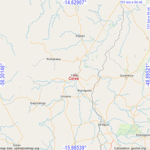
Ceres GPS coordinates[2]
15° 18' 29.988" South, 49° 35' 53.988" West
| Map corner | latitude | longitude |
|---|---|---|
| Upper-left | -14.62907°, | -50.30146° |
| Center: | -15.30833°, | -49.59833° |
| Lower-right: | -15.98539°, | -48.89521° |
| Map W x H: | 150.8×150.8 km | = 93.7×93.7mi |
| max Lat: | 2.81972° ⇑44.5% North |
| Ceres: | -15.30833° |
| min Lat: | ⇓55.5% South -33.69111° |
| min Long | Ceres | max Long |
| -72.89583° | -49.59833° | -32.41083° |
| W 23.8%⇐ | ⇒76.2% E |
Elevation
Elevation of Ceres is 586 m = 1923 ft, and this is 205.1 m = 673 ft above average elevation for this country.
| Max E: |
1603 m = 5259 ft | 28.6% |
| Ceres | 586 m 1923 ft | |
| Avg. | 380.9 m = 1250 ft | |
Min E: |
0 m = 0 ft | 71.4% |
See also: Brazil elevation on elevation.city.
Geographical zone
Ceres is located in South Torrid zone (between Equator and Tropic of Capricorn). Distance of this Southern Tropic circle is 903.8 km =561.6 mi to South.| Distance of | km | miles | from Ceres |
|---|---|---|---|
| Equator | 1702.1 | 1057.6 | to North |
| Tropic Capricorn | 903.8 | 561.6 | to South |
| Antarctic Circle | 5699 | 3541.2 | to South |
| South Pole | 8304.9 | 5160.4 | to South |


Nearby cities:
15 places around Ceres: (largest is in red/bold)
• Barro Alto
82.3 km =51.1 mi,  62°
62°
• Carmo do Rio Verde
12.7 km =7.9 mi,  246°
246°
• Crixás
93.4 km =58 mi,  334°
334°
• Goianésia
51.6 km =32.1 mi,  91°
91°
• Goiás
90.6 km =56.3 mi,  219°
219°
• Itaberaí
82.3 km =51.1 mi,  195°
195°
• Itapaci
40.1 km =24.9 mi,  7°
7°
• Itapuranga
47 km =29.2 mi,  233°
233°
• Jaraguá
57.3 km =35.6 mi,  150°
150°
• Petrolina de Goiás
91.8 km =57 mi,  162°
162°
• Pirenópolis
91.1 km =56.6 mi,  131°
131°
• Rialma
1.7 km =1.1 mi,  116°
116°
• Rubiataba
27.2 km =16.9 mi,  306°
306°
• Uruana
23.5 km =14.6 mi, 202°
• Uruaçu
100 km =62.1 mi,  29°
29°
Sources, notices
• [Note1] Compared only with cities in Brazil existing in our database
• [Src1] Map data: © OpenStreetMap contributors (CC-BY-SA)
• [Src2] Other city data from geonames.org with taken over terms of usage.
• [Src3] Geographical zone / Annual Mean Temperature by Robert A. Rohde @ Wikipedia
