Goianésia geodata
Goianésia (Goiás) is a populated place; located in Brazil in America/Sao_Paulo (GMT-3) time zone. With population of 47,883 people, there are 449 cities with bigger population in this country. Compared to other cities in Brazil, 55.3% of cities are located further ↓South; 72.3% of cities are located further →East and 76.6% of cities have lower elevation than Goianésia. Note1


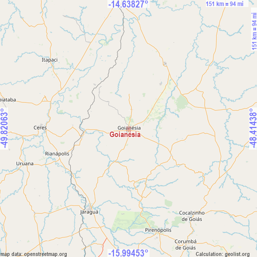
Goianésia GPS coordinates[2]
15° 19' 3" South, 49° 7' 3" West
| Map corner | latitude | longitude |
|---|---|---|
| Upper-left | -14.63827°, | -49.82063° |
| Center: | -15.3175°, | -49.1175° |
| Lower-right: | -15.99453°, | -48.41438° |
| Map W x H: | 150.8×150.8 km | = 93.7×93.7mi |
| max Lat: | 2.81972° ⇑44.7% North |
| Goianésia: | -15.3175° |
| min Lat: | ⇓55.3% South -33.69111° |
| min Long | Goianésia | max Long |
| -72.89583° | -49.1175° | -32.41083° |
| W 27.7%⇐ | ⇒72.3% E |
Elevation
Elevation of Goianésia is 649 m = 2129 ft, and this is 268.1 m = 880 ft above average elevation for this country.
| Max E: |
1603 m = 5259 ft | 23.4% |
| Goianésia | 649 m 2129 ft | |
| Avg. | 380.9 m = 1250 ft | |
Min E: |
0 m = 0 ft | 76.6% |
See also: Goianésia elevation on elevation.city.
Geographical zone
Goianésia is located in South Torrid zone (between Equator and Tropic of Capricorn). Distance of this Southern Tropic circle is 902.8 km =561 mi to South.| Distance of | km | miles | from Goianésia |
|---|---|---|---|
| Equator | 1703.1 | 1058.3 | to North |
| Tropic Capricorn | 902.8 | 561 | to South |
| Antarctic Circle | 5698 | 3540.6 | to South |
| South Pole | 8303.9 | 5159.8 | to South |


Nearby cities:
15 places around Goianésia: (largest is in red/bold)
• Abadiânia
107.9 km =67 mi,  155°
155°
• Barro Alto
44.2 km =27.5 mi,  29°
29°
• Carmo do Rio Verde
63.4 km =39.4 mi,  266°
266°
• Ceres
51.6 km =32.1 mi, 271°
• Itaberaí
107.7 km =66.9 mi,  223°
223°
• Itapaci
61.7 km =38.3 mi,  311°
311°
• Itapuranga
93.1 km =57.8 mi,  253°
253°
• Jaraguá
54.1 km =33.6 mi,  205°
205°
• Padre Bernardo
91.1 km =56.6 mi,  79°
79°
• Petrolina de Goiás
89.6 km =55.7 mi,  195°
195°
• Pirenópolis
61.6 km =38.3 mi, 164°
• Rialma
50.1 km =31.1 mi, 270°
• Rubiataba
75.5 km =46.9 mi,  283°
283°
• Uruana
64 km =39.8 mi, 251°
• Uruaçu
88.2 km =54.8 mi,  358°
358°
Sources, notices
• [Note1] Compared only with cities in Brazil existing in our database
• [Src1] Map data: © OpenStreetMap contributors (CC-BY-SA)
• [Src2] Other city data from geonames.org with taken over terms of usage.
• [Src3] Geographical zone / Annual Mean Temperature by Robert A. Rohde @ Wikipedia
