Pelotas geodata
Pelotas (Rio Grande do Sul) is a populated place; located in Brazil in America/Sao_Paulo (GMT-3) time zone. With population of 320,674 people, there are 66 cities with bigger population in this country. Compared to other cities in Brazil, 99.7% of cities are located further ↑North; 88.6% of cities are located further →East and 98.3% of cities have higher elevation than Pelotas. Note1


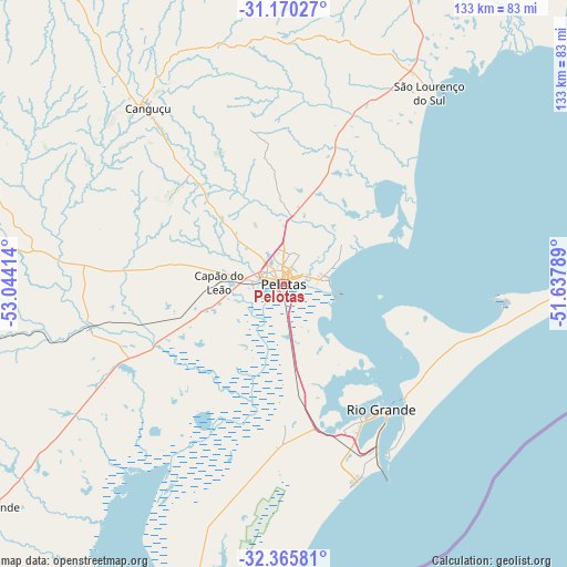
Pelotas GPS coordinates[2]
31° 46' 11.892" South, 52° 20' 27.636" West
| Map corner | latitude | longitude |
|---|---|---|
| Upper-left | -31.17027°, | -53.04414° |
| Center: | -31.76997°, | -52.34101° |
| Lower-right: | -32.36581°, | -51.63789° |
| Map W x H: | 132.9×132.9 km | = 82.6×82.6mi |
| max Lat: | 2.81972° ⇑99.7% North |
| Pelotas: | -31.76997° |
| min Lat: | ⇓0.3% South -33.69111° |
| min Long | Pelotas | max Long |
| -72.89583° | -52.34101° | -32.41083° |
| W 11.4%⇐ | ⇒88.6% E |
Elevation
Elevation of Pelotas is 6 m = 20 ft, and this is 374.9 m = 1230 ft below average elevation for this country.
| Max E: |
1603 m = 5259 ft | 98.3% |
| Avg. | 380.9 m = 1250 ft | |
| Pelotas | 6 m = 20 ft | |
Min E: |
0 m = 0 ft | 1.7% |
See also: Pelotas elevation on elevation.city.
Geographical zone
Pelotas is located in South temperate zone (between Tropic of Capricorn and the Antarctic Circle). Distance of this Southern Tropic circle is 926.6 km =575.8 mi to North.| Distance of | km | miles | from Pelotas |
|---|---|---|---|
| Equator | 3532.5 | 2195 | to North |
| Tropic Capricorn | 926.6 | 575.8 | to North |
| Antarctic Circle | 3868.7 | 2403.9 | to South |
| South Pole | 6474.6 | 4023.1 | to South |


Nearby cities:
15 places around Pelotas: (largest is in red/bold)
• Arroio Grande
87.5 km =54.4 mi,  233°
233°
• Arroio dos Ratos
197.1 km =122.5 mi,  17°
17°
• Bagé
174.3 km =108.3 mi,  286°
286°
• Butiá
187 km =116.2 mi,  11°
11°
• Camaquã
113.8 km =70.7 mi,  26°
26°
• Canguçu
52.4 km =32.6 mi,  322°
322°
• Caçapava do Sul
177 km =110 mi, 322°
• Encruzilhada do Sul
137.4 km =85.4 mi,  352°
352°
• Herval
103.5 km =64.3 mi,  254°
254°
• Jaguarão
131.6 km =81.8 mi, 227°
• Pinheiro Machado
100.7 km =62.6 mi,  282°
282°
• Rio Grande
37.3 km =23.2 mi,  142°
142°
• Rio Pardo
198 km =123 mi,  358°
358°
• São Lourenço do Sul
56.6 km =35.2 mi,  37°
37°
• Tapes
151.5 km =94.1 mi, 36°
Sources, notices
• [Note1] Compared only with cities in Brazil existing in our database
• [Src1] Map data: © OpenStreetMap contributors (CC-BY-SA)
• [Src2] Other city data from geonames.org with taken over terms of usage.
• [Src3] Geographical zone / Annual Mean Temperature by Robert A. Rohde @ Wikipedia
