Vacaria geodata
Vacaria (Rio Grande do Sul) is a populated place; located in Brazil in America/Sao_Paulo (GMT-3) time zone. With population of 56,765 people, there are 385 cities with bigger population in this country. Compared to other cities in Brazil, 95% of cities are located further ↑North; 82.1% of cities are located further →East and 97.8% of cities have lower elevation than Vacaria. Note1


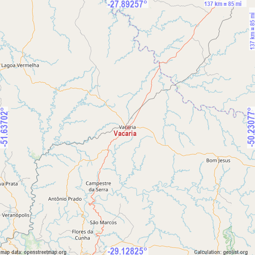
Vacaria GPS coordinates[2]
28° 30' 43.992" South, 50° 56' 2.004" West
| Map corner | latitude | longitude |
|---|---|---|
| Upper-left | -27.89257°, | -51.63702° |
| Center: | -28.51222°, | -50.93389° |
| Lower-right: | -29.12825°, | -50.23077° |
| Map W x H: | 137.4×137.4 km | = 85.4×85.4mi |
| max Lat: | 2.81972° ⇑95% North |
| Vacaria: | -28.51222° |
| min Lat: | ⇓5% South -33.69111° |
| min Long | Vacaria | max Long |
| -72.89583° | -50.93389° | -32.41083° |
| W 17.9%⇐ | ⇒82.1% E |
Elevation
Elevation of Vacaria is 970 m = 3182 ft, and this is 589.1 m = 1933 ft above average elevation for this country.
| Max E: |
1603 m = 5259 ft | 2.2% |
| Vacaria | 970 m 3182 ft | |
| Avg. | 380.9 m = 1250 ft | |
Min E: |
0 m = 0 ft | 97.8% |
See also: Vacaria elevation on elevation.city.
Geographical zone
Vacaria is located in South temperate zone (between Tropic of Capricorn and the Antarctic Circle). Distance of this Southern Tropic circle is 564.3 km =350.6 mi to North.| Distance of | km | miles | from Vacaria |
|---|---|---|---|
| Equator | 3170.3 | 1969.9 | to North |
| Tropic Capricorn | 564.3 | 350.6 | to North |
| Antarctic Circle | 4230.9 | 2629 | to South |
| South Pole | 6836.8 | 4248.2 | to South |


Nearby cities:
15 places around Vacaria: (largest is in red/bold)
• Bento Gonçalves
92.9 km =57.7 mi,  217°
217°
• Canela
94.6 km =58.8 mi,  172°
172°
• Caxias do Sul
76.7 km =47.7 mi,  198°
198°
• Estrela
50.2 km =31.2 mi,  359°
359°
• Farroupilha
88.9 km =55.2 mi,  206°
206°
• Flores da Cunha
62.3 km =38.7 mi, 202°
• Garibaldi
101.2 km =62.9 mi, 215°
• Guaporé
100.4 km =62.4 mi,  248°
248°
• Lages
97.7 km =60.7 mi,  37°
37°
• Lagoa Vermelha
67 km =41.6 mi,  300°
300°
• Nova Petrópolis
97.7 km =60.7 mi,  190°
190°
• Nova Prata
72.6 km =45.1 mi, 245°
• São Joaquim
101 km =62.8 mi,  76°
76°
• São Marcos
52.7 km =32.7 mi, 194°
• Veranópolis
76.3 km =47.4 mi,  231°
231°
Sources, notices
• [Note1] Compared only with cities in Brazil existing in our database
• [Src1] Map data: © OpenStreetMap contributors (CC-BY-SA)
• [Src2] Other city data from geonames.org with taken over terms of usage.
• [Src3] Geographical zone / Annual Mean Temperature by Robert A. Rohde @ Wikipedia
