João Pinheiro geodata
João Pinheiro (Minas Gerais) is a populated place; located in Brazil in America/Sao_Paulo (GMT-3) time zone. With population of 28,080 people, there are 705 cities with bigger population in this country. Compared to other cities in Brazil, 50.5% of cities are located further ↑North; 53.3% of cities are located further →East and 87.4% of cities have lower elevation than João Pinheiro. Note1


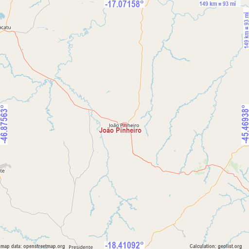
João Pinheiro GPS coordinates[2]
17° 44' 33" South, 46° 10' 21" West
| Map corner | latitude | longitude |
|---|---|---|
| Upper-left | -17.07158°, | -46.87563° |
| Center: | -17.7425°, | -46.1725° |
| Lower-right: | -18.41092°, | -45.46938° |
| Map W x H: | 148.9×148.9 km | = 92.5×92.5mi |
| max Lat: | 2.81972° ⇑50.5% North |
| João Pinheiro: | -17.7425° |
| min Lat: | ⇓49.5% South -33.69111° |
| min Long | João Pinheiro | max Long |
| -72.89583° | -46.1725° | -32.41083° |
| W 46.7%⇐ | ⇒53.3% E |
Elevation
Elevation of João Pinheiro is 775 m = 2543 ft, and this is 394.1 m = 1293 ft above average elevation for this country.
| Max E: |
1603 m = 5259 ft | 12.6% |
| João Pinheiro | 775 m 2543 ft | |
| Avg. | 380.9 m = 1250 ft | |
Min E: |
0 m = 0 ft | 87.4% |
See also: Brazil elevation on elevation.city.
Geographical zone
João Pinheiro is located in South Torrid zone (between Equator and Tropic of Capricorn). Distance of this Southern Tropic circle is 633.1 km =393.4 mi to South.| Distance of | km | miles | from João Pinheiro |
|---|---|---|---|
| Equator | 1972.8 | 1225.8 | to North |
| Tropic Capricorn | 633.1 | 393.4 | to South |
| Antarctic Circle | 5428.4 | 3373.1 | to South |
| South Pole | 8034.3 | 4992.3 | to South |


Nearby cities:
15 places around João Pinheiro: (largest is in red/bold)
• Abaeté
175.3 km =108.9 mi,  154°
154°
• Buritizeiro
135.5 km =84.2 mi,  71°
71°
• Carmo do Paranaíba
140.7 km =87.4 mi,  186°
186°
• Coromandel
135.7 km =84.3 mi,  233°
233°
• Lagoa Formosa
117.8 km =73.2 mi, 192°
• Monte Carmelo
177.6 km =110.4 mi, 232°
• Paracatu
94.3 km =58.6 mi,  307°
307°
• Patos de Minas
99.9 km =62.1 mi,  201°
201°
• Patrocínio
159.2 km =98.9 mi,  212°
212°
• Pirapora
137.7 km =85.6 mi, 71°
• Presidente Olegário
79.4 km =49.3 mi, 199°
• São Gotardo
174.9 km =108.7 mi,  175°
175°
• Unaí
172.6 km =107.2 mi,  333°
333°
• Vazante
82.4 km =51.2 mi,  250°
250°
• Várzea da Palma
153.3 km =95.3 mi,  83°
83°
Sources, notices
• [Note1] Compared only with cities in Brazil existing in our database
• [Src1] Map data: © OpenStreetMap contributors (CC-BY-SA)
• [Src2] Other city data from geonames.org with taken over terms of usage.
• [Src3] Geographical zone / Annual Mean Temperature by Robert A. Rohde @ Wikipedia
