Presidente Olegário geodata
Presidente Olegário (Minas Gerais) is a populated place; located in Brazil in America/Sao_Paulo (GMT-3) time zone. With population of 13,586 people, there are 1322 cities with bigger population in this country. Compared to other cities in Brazil, 51.6% of cities are located further ↑North; 54.5% of cities are located further →East and 97.5% of cities have lower elevation than Presidente Olegário. Note1


Presidente Olegário GPS coordinates[2]
18° 25' 4.008" South, 46° 25' 5.016" West
| Map corner | latitude | longitude |
|---|---|---|
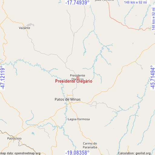
| Upper-left | -17.74939°, | -47.12119° |
| Center: | -18.41778°, | -46.41806° |
| Lower-right: | -19.08358°, | -45.71494° |
| Map W x H: | 148.3×148.4 km | = 92.1×92.2mi |
| max Lat: | 2.81972° ⇑51.6% North |
| Presidente Olegário: | -18.41778° |
| min Lat: | ⇓48.4% South -33.69111° |
| min Long | Presidente Oleg | max Long |
| -72.89583° | -46.41806° | -32.41083° |
| W 45.5%⇐ | ⇒54.5% E |
Elevation
Elevation of Presidente Olegário is 960 m = 3150 ft, and this is 579.1 m = 1900 ft above average elevation for this country.
| Max E: |
1603 m = 5259 ft | 2.5% |
| Presidente Olegário | 960 m 3150 ft | |
| Avg. | 380.9 m = 1250 ft | |
Min E: |
0 m = 0 ft | 97.5% |
See also: Brazil elevation on elevation.city.
Geographical zone
Presidente Olegário is located in South Torrid zone (between Equator and Tropic of Capricorn). Distance of this Southern Tropic circle is 558.1 km =346.8 mi to South.| Distance of | km | miles | from Presidente Olegário |
|---|---|---|---|
| Equator | 2047.9 | 1272.5 | to North |
| Tropic Capricorn | 558.1 | 346.8 | to South |
| Antarctic Circle | 5353.3 | 3326.4 | to South |
| South Pole | 7959.2 | 4945.6 | to South |


Nearby cities:
15 places around Presidente Olegário: (largest is in red/bold)
• Abaeté
131.5 km =81.7 mi,  128°
128°
• Araxá
141.8 km =88.1 mi,  202°
202°
• Campos Altos
144.5 km =89.8 mi,  169°
169°
• Carmo do Paranaíba
65.7 km =40.8 mi, 170°
• Coromandel
82.7 km =51.4 mi,  265°
265°
• Dores do Indaiá
144.5 km =89.8 mi,  143°
143°
• Ibiá
118.6 km =73.7 mi,  186°
186°
• João Pinheiro
79.4 km =49.3 mi,  19°
19°
• Lagoa Formosa
40.1 km =24.9 mi,  178°
178°
• Monte Carmelo
118.9 km =73.9 mi,  253°
253°
• Paracatu
141.4 km =87.9 mi,  340°
340°
• Patos de Minas
20.8 km =12.9 mi,  210°
210°
• Patrocínio
84.2 km =52.3 mi,  225°
225°
• São Gotardo
106.7 km =66.3 mi,  158°
158°
• Vazante
70.5 km =43.8 mi,  312°
312°
Sources, notices
• [Note1] Compared only with cities in Brazil existing in our database
• [Src1] Map data: © OpenStreetMap contributors (CC-BY-SA)
• [Src2] Other city data from geonames.org with taken over terms of usage.
• [Src3] Geographical zone / Annual Mean Temperature by Robert A. Rohde @ Wikipedia
