Itaqui geodata
Itaqui (Rio Grande do Sul) is a populated place; located in Brazil in America/Sao_Paulo (GMT-3) time zone. With population of 34,631 people, there are 591 cities with bigger population in this country. Compared to other cities in Brazil, 96.1% of cities are located further ↑North; 96% of cities are located further →East and 77.4% of cities have higher elevation than Itaqui. Note1


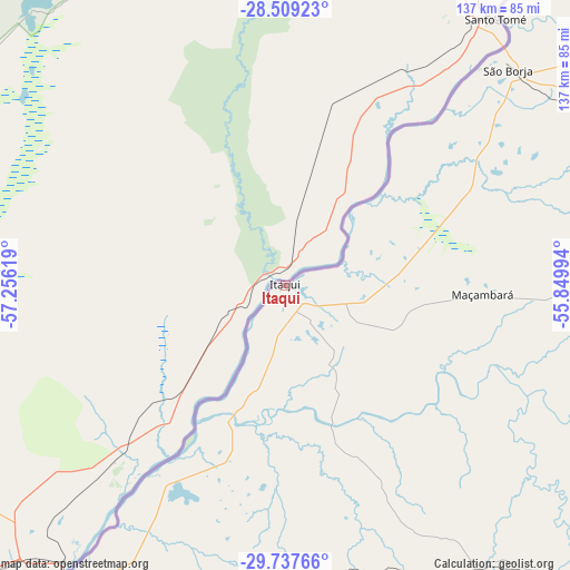
Itaqui GPS coordinates[2]
29° 7' 31.008" South, 56° 33' 11.016" West
| Map corner | latitude | longitude |
|---|---|---|
| Upper-left | -28.50923°, | -57.25619° |
| Center: | -29.12528°, | -56.55306° |
| Lower-right: | -29.73766°, | -55.84994° |
| Map W x H: | 136.6×136.6 km | = 84.9×84.9mi |
| max Lat: | 2.81972° ⇑96.1% North |
| Itaqui: | -29.12528° |
| min Lat: | ⇓3.9% South -33.69111° |
| min Long | Itaqui | max Long |
| -72.89583° | -56.55306° | -32.41083° |
| W 4%⇐ | ⇒96% E |
Elevation
Elevation of Itaqui is 61 m = 200 ft, and this is 319.9 m = 1050 ft below average elevation for this country.
| Max E: |
1603 m = 5259 ft | 77.4% |
| Avg. | 380.9 m = 1250 ft | |
| Itaqui | 61 m = 200 ft | |
Min E: |
0 m = 0 ft | 22.6% |
See also: Brazil elevation on elevation.city.
Geographical zone
Itaqui is located in South temperate zone (between Tropic of Capricorn and the Antarctic Circle). Distance of this Southern Tropic circle is 632.5 km =393 mi to North.| Distance of | km | miles | from Itaqui |
|---|---|---|---|
| Equator | 3238.4 | 2012.2 | to North |
| Tropic Capricorn | 632.5 | 393 | to North |
| Antarctic Circle | 4162.7 | 2586.6 | to South |
| South Pole | 6768.6 | 4205.8 | to South |


Nearby cities:
15 places around Itaqui: (largest is in red/bold)
• Alegrete
103.8 km =64.5 mi,  134°
134°
• Butia Inferior
200.6 km =124.6 mi,  54°
54°
• Cacequi
187.3 km =116.4 mi,  116°
116°
• Cerro Largo
207.8 km =129.1 mi,  58°
58°
• Quaraí
140.7 km =87.4 mi,  176°
176°
• Rosário do Sul
202.3 km =125.7 mi, 128°
• Santa Rosa
245.8 km =152.7 mi, 55°
• Santana do Livramento
219.5 km =136.4 mi,  153°
153°
• Santiago
163.9 km =101.8 mi,  92°
92°
• Santo Ângelo
241.5 km =150.1 mi,  67°
67°
• São Borja
74.3 km =46.2 mi, 45°
• São Francisco de Assis
145.7 km =90.5 mi,  108°
108°
• São Luiz Gonzaga
174.5 km =108.4 mi, 62°
• São Pedro do Sul
236.5 km =147 mi,  103°
103°
• Uruguaiana
87.1 km =54.1 mi,  216°
216°
Sources, notices
• [Note1] Compared only with cities in Brazil existing in our database
• [Src1] Map data: © OpenStreetMap contributors (CC-BY-SA)
• [Src2] Other city data from geonames.org with taken over terms of usage.
• [Src3] Geographical zone / Annual Mean Temperature by Robert A. Rohde @ Wikipedia
