Espera Feliz geodata
Espera Feliz (Minas Gerais) is a populated place; located in Brazil in America/Sao_Paulo (GMT-3) time zone. With population of 13,030 people, there are 1366 cities with bigger population in this country. Compared to other cities in Brazil, 60.8% of cities are located further ↑North; 66.3% of cities are located further ←West and 86% of cities have lower elevation than Espera Feliz. Note1


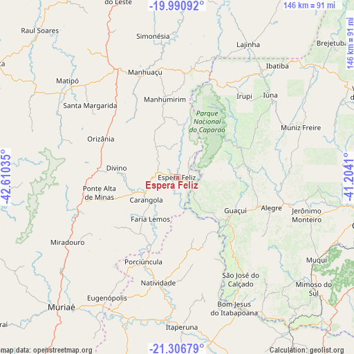
Espera Feliz GPS coordinates[2]
20° 39' 1.008" South, 41° 54' 25.992" West
| Map corner | latitude | longitude |
|---|---|---|
| Upper-left | -19.99092°, | -42.61035° |
| Center: | -20.65028°, | -41.90722° |
| Lower-right: | -21.30679°, | -41.2041° |
| Map W x H: | 146.3×146.3 km | = 90.9×90.9mi |
| max Lat: | 2.81972° ⇑60.8% North |
| Espera Feliz: | -20.65028° |
| min Lat: | ⇓39.2% South -33.69111° |
| min Long | Espera Feliz | max Long |
| -72.89583° | -41.90722° | -32.41083° |
| W 66.3%⇐ | ⇒33.7% E |
Elevation
Elevation of Espera Feliz is 767 m = 2516 ft, and this is 386.1 m = 1267 ft above average elevation for this country.
| Max E: |
1603 m = 5259 ft | 14% |
| Espera Feliz | 767 m 2516 ft | |
| Avg. | 380.9 m = 1250 ft | |
Min E: |
0 m = 0 ft | 86% |
See also: Brazil elevation on elevation.city.
Geographical zone
Espera Feliz is located in South Torrid zone (between Equator and Tropic of Capricorn). Distance of this Southern Tropic circle is 309.8 km =192.5 mi to South.| Distance of | km | miles | from Espera Feliz |
|---|---|---|---|
| Equator | 2296.1 | 1426.7 | to North |
| Tropic Capricorn | 309.8 | 192.5 | to South |
| Antarctic Circle | 5105.1 | 3172.2 | to South |
| South Pole | 7711 | 4791.4 | to South |


Nearby cities:
15 places around Espera Feliz: (largest is in red/bold)
• Alegre
40.9 km =25.4 mi,  107°
107°
• Bom Jesus do Itabapoana
58.7 km =36.5 mi,  156°
156°
• Carangola
15.7 km =9.8 mi,  234°
234°
• Guaçuí
27.5 km =17.1 mi,  120°
120°
• Irupi
43.8 km =27.2 mi,  39°
39°
• Itaperuna
61.7 km =38.3 mi,  178°
178°
• Iúna
51.4 km =31.9 mi,  48°
48°
• Jerônimo Monteiro
55.5 km =34.5 mi, 106°
• Manhuaçu
45.6 km =28.3 mi,  343°
343°
• Manhumirim
33 km =20.5 mi,  350°
350°
• Matipó
60.8 km =37.8 mi,  312°
312°
• Muniz Freire
55.5 km =34.5 mi,  68°
68°
• Natividade
44.1 km =27.4 mi,  188°
188°
• Porciúncula
37.4 km =23.2 mi,  201°
201°
• São José do Calçado
49.3 km =30.6 mi,  147°
147°
Sources, notices
• [Note1] Compared only with cities in Brazil existing in our database
• [Src1] Map data: © OpenStreetMap contributors (CC-BY-SA)
• [Src2] Other city data from geonames.org with taken over terms of usage.
• [Src3] Geographical zone / Annual Mean Temperature by Robert A. Rohde @ Wikipedia
