Correntina geodata
Correntina (Bahia) is a populated place; located in Brazil in America/Bahia (GMT-3) time zone. With population of 13,186 people, there are 1359 cities with bigger population in this country. Compared to other cities in Brazil, 59.4% of cities are located further ↓South; 53% of cities are located further ←West and 71.1% of cities have lower elevation than Correntina. Note1


Correntina GPS coordinates[2]
13° 20' 35.988" South, 44° 38' 12.012" West
| Map corner | latitude | longitude |
|---|---|---|
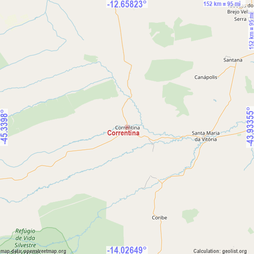
| Upper-left | -12.65823°, | -45.3398° |
| Center: | -13.34333°, | -44.63667° |
| Lower-right: | -14.02649°, | -43.93355° |
| Map W x H: | 152.1×152.1 km | = 94.5×94.5mi |
| max Lat: | 2.81972° ⇑40.6% North |
| Correntina: | -13.34333° |
| min Lat: | ⇓59.4% South -33.69111° |
| min Long | Correntina | max Long |
| -72.89583° | -44.63667° | -32.41083° |
| W 53%⇐ | ⇒47% E |
Elevation
Elevation of Correntina is 584 m = 1916 ft, and this is 203.1 m = 666 ft above average elevation for this country.
| Max E: |
1603 m = 5259 ft | 28.9% |
| Correntina | 584 m 1916 ft | |
| Avg. | 380.9 m = 1250 ft | |
Min E: |
0 m = 0 ft | 71.1% |
See also: Brazil elevation on elevation.city.
Geographical zone
Correntina is located in South Torrid zone (between Equator and Tropic of Capricorn). Distance of this Southern Tropic circle is 1122.3 km =697.4 mi to South.| Distance of | km | miles | from Correntina |
|---|---|---|---|
| Equator | 1483.6 | 921.9 | to North |
| Tropic Capricorn | 1122.3 | 697.4 | to South |
| Antarctic Circle | 5917.5 | 3677 | to South |
| South Pole | 8523.4 | 5296.2 | to South |


Nearby cities:
15 places around Correntina: (largest is in red/bold)
• Barreiras
137.8 km =85.6 mi,  343°
343°
• Bom Jesus da Lapa
132.2 km =82.1 mi,  85°
85°
• Carinhanha
142.4 km =88.5 mi,  138°
138°
• Ibotirama
200.4 km =124.5 mi,  50°
50°
• Itacarambi
204.2 km =126.9 mi,  163°
163°
• Macaúbas
212.9 km =132.3 mi,  80°
80°
• Manga
174.5 km =108.4 mi,  154°
154°
• Palmas de Monte Alto
189.5 km =117.7 mi,  122°
122°
• Paratinga
173.3 km =107.7 mi,  65°
65°
• Posse
204.9 km =127.3 mi,  245°
245°
• Riacho de Santana
185.9 km =115.5 mi,  99°
99°
• Riachão das Neves
180.1 km =111.9 mi,  350°
350°
• Santa Maria da Vitória
47.6 km =29.6 mi, 96°
• São Desidério
114.9 km =71.4 mi, 341°
• São Domingos
182 km =113.1 mi,  268°
268°
Sources, notices
• [Note1] Compared only with cities in Brazil existing in our database
• [Src1] Map data: © OpenStreetMap contributors (CC-BY-SA)
• [Src2] Other city data from geonames.org with taken over terms of usage.
• [Src3] Geographical zone / Annual Mean Temperature by Robert A. Rohde @ Wikipedia
