Manga geodata
Manga (Minas Gerais) is a populated place; located in Brazil in America/Sao_Paulo (GMT-3) time zone. With population of 11,732 people, there are 1503 cities with bigger population in this country. Compared to other cities in Brazil, 56.7% of cities are located further ↓South; 56.2% of cities are located further ←West and 58.2% of cities have lower elevation than Manga. Note1


Manga GPS coordinates[2]
14° 45' 20.988" South, 43° 55' 55.992" West
| Map corner | latitude | longitude |
|---|---|---|
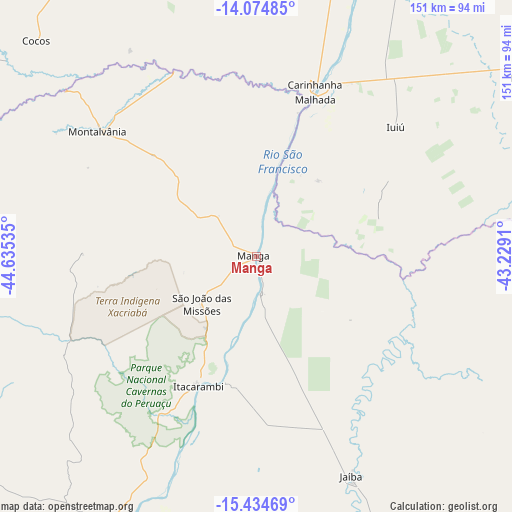
| Upper-left | -14.07485°, | -44.63535° |
| Center: | -14.75583°, | -43.93222° |
| Lower-right: | -15.43469°, | -43.2291° |
| Map W x H: | 151.2×151.2 km | = 94×94mi |
| max Lat: | 2.81972° ⇑43.3% North |
| Manga: | -14.75583° |
| min Lat: | ⇓56.7% South -33.69111° |
| min Long | Manga | max Long |
| -72.89583° | -43.93222° | -32.41083° |
| W 56.2%⇐ | ⇒43.8% E |
Elevation
Elevation of Manga is 454 m = 1490 ft, and this is 73.1 m = 240 ft above average elevation for this country.
| Max E: |
1603 m = 5259 ft | 41.8% |
| Manga | 454 m 1490 ft | |
| Avg. | 380.9 m = 1250 ft | |
Min E: |
0 m = 0 ft | 58.2% |
See also: Brazil elevation on elevation.city.
Geographical zone
Manga is located in South Torrid zone (between Equator and Tropic of Capricorn). Distance of this Southern Tropic circle is 965.2 km =599.7 mi to South.| Distance of | km | miles | from Manga |
|---|---|---|---|
| Equator | 1640.7 | 1019.5 | to North |
| Tropic Capricorn | 965.2 | 599.7 | to South |
| Antarctic Circle | 5760.5 | 3579.4 | to South |
| South Pole | 8366.4 | 5198.6 | to South |


Nearby cities:
15 places around Manga: (largest is in red/bold)
• Barreiro do Jaíba
102.3 km =63.6 mi,  159°
159°
• Carinhanha
53.3 km =33.1 mi,  19°
19°
• Espinosa
121.1 km =75.2 mi,  98°
98°
• Guanambi
137.3 km =85.3 mi,  64°
64°
• Itacarambi
42.2 km =26.2 mi,  204°
204°
• Janaúba
134.2 km =83.4 mi,  150°
150°
• Januária
93.5 km =58.1 mi,  209°
209°
• Mato Verde
134.8 km =83.8 mi,  121°
121°
• Monte Azul
122 km =75.8 mi,  111°
111°
• Palmas de Monte Alto
99.1 km =61.6 mi, 56°
• Porteirinha
146.5 km =91 mi,  138°
138°
• Santa Maria da Vitória
154.8 km =96.2 mi,  349°
349°
• São Francisco
166.1 km =103.2 mi,  217°
217°
• São João da Ponte
130.7 km =81.2 mi,  183°
183°
• Varzelândia
105.6 km =65.6 mi,  185°
185°
Sources, notices
• [Note1] Compared only with cities in Brazil existing in our database
• [Src1] Map data: © OpenStreetMap contributors (CC-BY-SA)
• [Src2] Other city data from geonames.org with taken over terms of usage.
• [Src3] Geographical zone / Annual Mean Temperature by Robert A. Rohde @ Wikipedia
