Caarapó geodata
Caarapó (Mato Grosso do Sul) is a populated place; located in Brazil in America/Campo_Grande (GMT-4) time zone. With population of 13,863 people, there are 1303 cities with bigger population in this country. Compared to other cities in Brazil, 75% of cities are located further ↑North; 94% of cities are located further →East and 59.7% of cities have lower elevation than Caarapó. Note1


Caarapó GPS coordinates[2]
22° 38' 3.012" South, 54° 49' 19.992" West
| Map corner | latitude | longitude |
|---|---|---|
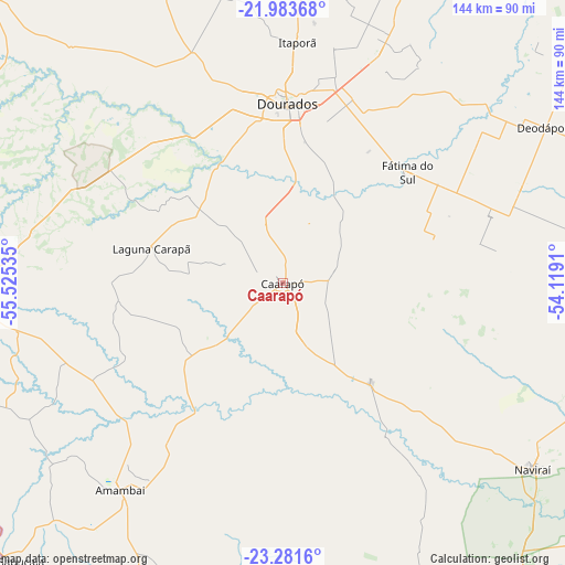
| Upper-left | -21.98368°, | -55.52535° |
| Center: | -22.63417°, | -54.82222° |
| Lower-right: | -23.2816°, | -54.1191° |
| Map W x H: | 144.3×144.3 km | = 89.7×89.7mi |
| max Lat: | 2.81972° ⇑75% North |
| Caarapó: | -22.63417° |
| min Lat: | ⇓25% South -33.69111° |
| min Long | Caarapó | max Long |
| -72.89583° | -54.82222° | -32.41083° |
| W 6%⇐ | ⇒94% E |
Elevation
Elevation of Caarapó is 469 m = 1539 ft, and this is 88.1 m = 289 ft above average elevation for this country.
| Max E: |
1603 m = 5259 ft | 40.3% |
| Caarapó | 469 m 1539 ft | |
| Avg. | 380.9 m = 1250 ft | |
Min E: |
0 m = 0 ft | 59.7% |
See also: Brazil elevation on elevation.city.
Geographical zone
Caarapó is located in South Torrid zone (between Equator and Tropic of Capricorn). Distance of this Southern Tropic circle is 89.2 km =55.4 mi to South.| Distance of | km | miles | from Caarapó |
|---|---|---|---|
| Equator | 2516.7 | 1563.8 | to North |
| Tropic Capricorn | 89.2 | 55.4 | to South |
| Antarctic Circle | 4884.5 | 3035.1 | to South |
| South Pole | 7490.4 | 4654.3 | to South |


Nearby cities:
15 places around Caarapó: (largest is in red/bold)
• Altãnia
166.9 km =103.7 mi,  145°
145°
• Bataiporã
163.8 km =101.8 mi,  76°
76°
• Bela Vista
184.2 km =114.5 mi,  288°
288°
• Costa Rica
88.8 km =55.2 mi,  168°
168°
• Dourados
46 km =28.6 mi,  2°
2°
• Eldorado
139.5 km =86.7 mi,  156°
156°
• Guia Lopes da Laguna
186.6 km =115.9 mi,  314°
314°
• Iguatemi
119.3 km =74.1 mi, 167°
• Loanda
175.7 km =109.2 mi,  100°
100°
• Maracaju
118.9 km =73.9 mi,  342°
342°
• Naviraí
80.5 km =50 mi,  126°
126°
• Paranhos
153.1 km =95.1 mi,  203°
203°
• Ponta Porã
93.4 km =58 mi,  276°
276°
• Pôrto Barra do Ivinheima
124.1 km =77.1 mi,  107°
107°
• Rio Brilhante
96.8 km =60.1 mi,  17°
17°
Sources, notices
• [Note1] Compared only with cities in Brazil existing in our database
• [Src1] Map data: © OpenStreetMap contributors (CC-BY-SA)
• [Src2] Other city data from geonames.org with taken over terms of usage.
• [Src3] Geographical zone / Annual Mean Temperature by Robert A. Rohde @ Wikipedia
