Paranhos geodata
Paranhos (Mato Grosso do Sul) is a populated place; located in Brazil in America/Campo_Grande (GMT-4) time zone. With population of 6,516 people, there are 1854 cities with bigger population in this country. Compared to other cities in Brazil, 85.6% of cities are located further ↑North; 94.5% of cities are located further →East and 54.7% of cities have lower elevation than Paranhos. Note1


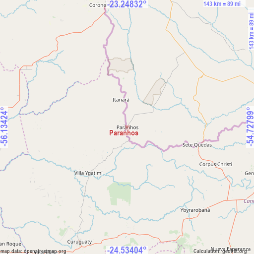
Paranhos GPS coordinates[2]
23° 53' 34.008" South, 55° 25' 51.996" West
| Map corner | latitude | longitude |
|---|---|---|
| Upper-left | -23.24832°, | -56.13424° |
| Center: | -23.89278°, | -55.43111° |
| Lower-right: | -24.53404°, | -54.72799° |
| Map W x H: | 143×143 km | = 88.9×88.9mi |
| max Lat: | 2.81972° ⇑85.6% North |
| Paranhos: | -23.89278° |
| min Lat: | ⇓14.4% South -33.69111° |
| min Long | Paranhos | max Long |
| -72.89583° | -55.43111° | -32.41083° |
| W 5.5%⇐ | ⇒94.5% E |
Elevation
Elevation of Paranhos is 417 m = 1368 ft, and this is 36.1 m = 118 ft above average elevation for this country.
| Max E: |
1603 m = 5259 ft | 45.3% |
| Paranhos | 417 m 1368 ft | |
| Avg. | 380.9 m = 1250 ft | |
Min E: |
0 m = 0 ft | 54.7% |
See also: Brazil elevation on elevation.city.
Geographical zone
Paranhos is located in South temperate zone (between Tropic of Capricorn and the Antarctic Circle). Distance of this Southern Tropic circle is 50.7 km =31.5 mi to North.| Distance of | km | miles | from Paranhos |
|---|---|---|---|
| Equator | 2656.6 | 1650.7 | to North |
| Tropic Capricorn | 50.7 | 31.5 | to North |
| Antarctic Circle | 4744.5 | 2948.1 | to South |
| South Pole | 7350.4 | 4567.3 | to South |


Nearby cities:
15 places around Paranhos: (largest is in red/bold)
• Alto Piquiri
202.8 km =126 mi,  94°
94°
• Altãnia
155.5 km =96.6 mi, 89°
• Caarapó
153.1 km =95.1 mi,  23°
23°
• Costa Rica
95.6 km =59.4 mi,  56°
56°
• Dourados
196.6 km =122.2 mi, 18°
• Eldorado
117.3 km =72.9 mi,  84°
84°
• Foz do Iguaçu
202.8 km =126 mi,  155°
155°
• Iguatemi
91.6 km =56.9 mi, 75°
• Iporã
175.9 km =109.3 mi, 93°
• Marechal Cândido Rondon
157.7 km =98 mi,  117°
117°
• Naviraí
156.5 km =97.2 mi,  53°
53°
• Palotina
167.3 km =104 mi,  105°
105°
• Ponta Porã
153.8 km =95.6 mi,  348°
348°
• São Miguel do Iguaçu
201.8 km =125.4 mi,  143°
143°
• Toledo
193.9 km =120.5 mi, 118°
Sources, notices
• [Note1] Compared only with cities in Brazil existing in our database
• [Src1] Map data: © OpenStreetMap contributors (CC-BY-SA)
• [Src2] Other city data from geonames.org with taken over terms of usage.
• [Src3] Geographical zone / Annual Mean Temperature by Robert A. Rohde @ Wikipedia
