Tucumã geodata
Tucumã (Pará) is a populated place; located in Brazil in America/Belem (GMT-3) time zone. With population of 38,508 people, there are 544 cities with bigger population in this country. Compared to other cities in Brazil, 81.9% of cities are located further ↓South; 83.5% of cities are located further →East and 52.9% of cities have higher elevation than Tucumã. Note1


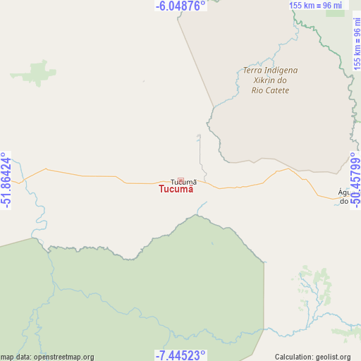
Tucumã GPS coordinates[2]
6° 44' 51" South, 51° 9' 39.996" West
| Map corner | latitude | longitude |
|---|---|---|
| Upper-left | -6.04876°, | -51.86424° |
| Center: | -6.7475°, | -51.16111° |
| Lower-right: | -7.44523°, | -50.45799° |
| Map W x H: | 155.3×155.3 km | = 96.5×96.5mi |
| max Lat: | 2.81972° ⇑18.1% North |
| Tucumã: | -6.7475° |
| min Lat: | ⇓81.9% South -33.69111° |
| min Long | Tucumã | max Long |
| -72.89583° | -51.16111° | -32.41083° |
| W 16.5%⇐ | ⇒83.5% E |
Elevation
Elevation of Tucumã is 302 m = 991 ft, and this is 78.9 m = 259 ft below average elevation for this country.
| Max E: |
1603 m = 5259 ft | 52.9% |
| Avg. | 380.9 m = 1250 ft | |
| Tucumã | 302 m = 991 ft | |
Min E: |
0 m = 0 ft | 47.1% |
See also: Brazil elevation on elevation.city.
Geographical zone
Tucumã is located in South Torrid zone (between Equator and Tropic of Capricorn). Distance of Equator is 750.3 km =466.2 mi to North.| Distance of | km | miles | from Tucumã |
|---|---|---|---|
| Equator | 750.3 | 466.2 | to North |
| Tropic Capricorn | 1855.7 | 1153.1 | to South |
| Antarctic Circle | 6650.9 | 4132.7 | to South |
| South Pole | 9256.8 | 5751.9 | to South |


Nearby cities:
15 places around Tucumã: (largest is in red/bold)
• Altamira
410.7 km =255.2 mi,  343°
343°
• Araguaína
329.7 km =204.9 mi,  98°
98°
• Carolina
413.4 km =256.9 mi, 99°
• Conceição do Araguaia
268.2 km =166.7 mi,  128°
128°
• Itupiranga
270.8 km =168.3 mi,  48°
48°
• Marabá
270.9 km =168.3 mi,  55°
55°
• Ourilândia do Norte
8.6 km =5.3 mi, 95°
• Parauapebas
158.3 km =98.4 mi, 61°
• Porto Franco
418 km =259.7 mi,  83°
83°
• Redenção
189.2 km =117.6 mi,  138°
138°
• Santa Terezinha
420 km =261 mi,  170°
170°
• São Félix do Xingu
92.8 km =57.7 mi,  277°
277°
• São Geraldo do Araguaia
290.4 km =180.4 mi, 82°
• Tucuruí
369.9 km =229.8 mi,  26°
26°
• Xinguara
139.9 km =86.9 mi,  106°
106°
Sources, notices
• [Note1] Compared only with cities in Brazil existing in our database
• [Src1] Map data: © OpenStreetMap contributors (CC-BY-SA)
• [Src2] Other city data from geonames.org with taken over terms of usage.
• [Src3] Geographical zone / Annual Mean Temperature by Robert A. Rohde @ Wikipedia
