Itupiranga geodata
Itupiranga (Pará) is a populated place; located in Brazil in America/Belem (GMT-3) time zone. With population of 21,301 people, there are 896 cities with bigger population in this country. Compared to other cities in Brazil, 88.3% of cities are located further ↓South; 74.2% of cities are located further →East and 73% of cities have higher elevation than Itupiranga. Note1


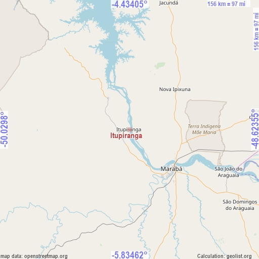
Itupiranga GPS coordinates[2]
5° 8' 4.992" South, 49° 19' 36.012" West
| Map corner | latitude | longitude |
|---|---|---|
| Upper-left | -4.43405°, | -50.0298° |
| Center: | -5.13472°, | -49.32667° |
| Lower-right: | -5.83462°, | -48.62355° |
| Map W x H: | 155.7×155.7 km | = 96.7×96.7mi |
| max Lat: | 2.81972° ⇑11.7% North |
| Itupiranga: | -5.13472° |
| min Lat: | ⇓88.3% South -33.69111° |
| min Long | Itupiranga | max Long |
| -72.89583° | -49.32667° | -32.41083° |
| W 25.8%⇐ | ⇒74.2% E |
Elevation
Elevation of Itupiranga is 95 m = 312 ft, and this is 285.9 m = 938 ft below average elevation for this country.
| Max E: |
1603 m = 5259 ft | 73% |
| Avg. | 380.9 m = 1250 ft | |
| Itupiranga | 95 m = 312 ft | |
Min E: |
0 m = 0 ft | 27% |
See also: Brazil elevation on elevation.city.
Geographical zone
Itupiranga is located in South Torrid zone (between Equator and Tropic of Capricorn). Distance of Equator is 570.9 km =354.7 mi to North.| Distance of | km | miles | from Itupiranga |
|---|---|---|---|
| Equator | 570.9 | 354.7 | to North |
| Tropic Capricorn | 2035 | 1264.5 | to South |
| Antarctic Circle | 6830.2 | 4244.1 | to South |
| South Pole | 9436.1 | 5863.3 | to South |


Nearby cities:
15 places around Itupiranga: (largest is in red/bold)
• Amarante do Maranhão
290.1 km =180.3 mi,  99°
99°
• Araguaína
260 km =161.6 mi,  151°
151°
• Baião
263.4 km =163.7 mi,  351°
351°
• Imperatriz
207.8 km =129.1 mi, 102°
• Marabá
34.9 km =21.7 mi,  141°
141°
• Mocajuba
284.3 km =176.7 mi,  355°
355°
• Montes Altos
261.9 km =162.7 mi,  107°
107°
• Ourilândia do Norte
265 km =164.7 mi,  227°
227°
• Paragominas
316.1 km =196.4 mi,  40°
40°
• Parauapebas
121.7 km =75.6 mi,  211°
211°
• Porto Franco
251.8 km =156.5 mi,  122°
122°
• São Geraldo do Araguaia
164.6 km =102.3 mi, 148°
• Tucumã
270.8 km =168.3 mi, 228°
• Tucuruí
157.1 km =97.6 mi, 345°
• Xinguara
228.7 km =142.1 mi,  197°
197°
Sources, notices
• [Note1] Compared only with cities in Brazil existing in our database
• [Src1] Map data: © OpenStreetMap contributors (CC-BY-SA)
• [Src2] Other city data from geonames.org with taken over terms of usage.
• [Src3] Geographical zone / Annual Mean Temperature by Robert A. Rohde @ Wikipedia
