Brockville geodata
Brockville (Ontario) is a populated place; located in Canada in America/Toronto (GMT-4) time zone. With population of 23,886 people, there are 168 cities with bigger population in this country. Compared to other cities in Canada, 87.1% of cities are located further ↑North; 56% of cities are located further ←West and 61.1% of cities have higher elevation than Brockville. Note1


Brockville GPS coordinates[2]
44° 35' 28.752" North, 75° 41' 13.38" West
| Map corner | latitude | longitude |
|---|---|---|
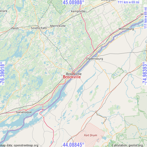
| Upper-left | 45.08988°, | -76.39018° |
| Center: | 44.59132°, | -75.68705° |
| Lower-right: | 44.08845°, | -74.98393° |
| Map W x H: | 111.3×111.3 km | = 69.2×69.2mi |
| max Lat: | 73.03752° ⇑87.1% North |
| Brockville: | 44.59132° |
| min Lat: | ⇓12.9% South 42.05009° |
| min Long | Brockville | max Long |
| -139.43328° | -75.68705° | -52.70931° |
| W 56%⇐ | ⇒44% E |
Elevation
Elevation of Brockville is 93 m = 305 ft, and this is 161.4 m = 530 ft below average elevation for this country.
| Max E: |
1518 m = 4980 ft | 61.1% |
| Avg. | 254.4 m = 835 ft | |
| Brockville | 93 m = 305 ft | |
Min E: |
-2 m = -7 ft | 38.9% |
See also: Canada elevation on elevation.city.
Geographical zone
Brockville is located in North temperate zone (between Tropic of Cancer and the Arctic Circle). Distance of this Northern Tropic circle is 2352.2 km =1461.6 mi to South.| Distance of | km | miles | from Brockville |
|---|---|---|---|
| North Pole | 5049 | 3137.3 | to North |
| Arctic Circle | 2443.1 | 1518.1 | to North |
| Tropic Cancer | 2352.2 | 1461.6 | to South |
| Equator | 4958.1 | 3080.8 | to South |


Nearby cities:
15 places around Brockville: (largest is in red/bold)
• Athens
21.3 km =13.2 mi,  282°
282°
• Bells Corners
81.3 km =50.5 mi,  352°
352°
• Carleton Place
70.4 km =43.7 mi,  328°
328°
• Gananoque
47.6 km =29.6 mi,  232°
232°
• Kanata
80.8 km =50.2 mi, 347°
• Kingston
74.8 km =46.5 mi,  237°
237°
• Metcalfe
73.5 km =45.7 mi,  13°
13°
• Morrisburg
52.6 km =32.7 mi,  49°
49°
• Osgoode
62.4 km =38.8 mi, 6°
• Perth
56.1 km =34.9 mi,  307°
307°
• Prescott
19.4 km =12.1 mi,  44°
44°
• Richmond
66.8 km =41.5 mi, 350°
• Russell
77.5 km =48.2 mi,  19°
19°
• Smiths Falls
43.8 km =27.2 mi,  322°
322°
• Winchester
60.8 km =37.8 mi,  25°
25°
Sources, notices
• [Note1] Compared only with cities in Canada existing in our database
• [Src1] Map data: © OpenStreetMap contributors (CC-BY-SA)
• [Src2] Other city data from geonames.org with taken over terms of usage.
• [Src3] Geographical zone / Annual Mean Temperature by Robert A. Rohde @ Wikipedia
