Bromont geodata
Bromont (Quebec) is a populated place; located in Canada in America/Toronto (GMT-4) time zone. With population of 3,895 people, there are 542 cities with bigger population in this country. Compared to other cities in Canada, 80.5% of cities are located further ↑North; 73.8% of cities are located further ←West and 56.4% of cities have higher elevation than Bromont. Note1


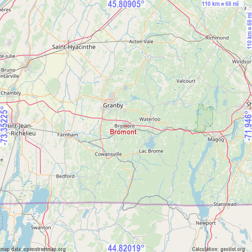
Bromont GPS coordinates[2]
45° 19' 0.408" North, 72° 38' 56.832" West
| Map corner | latitude | longitude |
|---|---|---|
| Upper-left | 45.80905°, | -73.35225° |
| Center: | 45.31678°, | -72.64912° |
| Lower-right: | 44.82019°, | -71.946° |
| Map W x H: | 110×109.9 km | = 68.4×68.3mi |
| max Lat: | 73.03752° ⇑80.5% North |
| Bromont: | 45.31678° |
| min Lat: | ⇓19.5% South 42.05009° |
| min Long | Bromont | max Long |
| -139.43328° | -72.64912° | -52.70931° |
| W 73.8%⇐ | ⇒26.2% E |
Elevation
Elevation of Bromont is 126 m = 413 ft, and this is 128.4 m = 421 ft below average elevation for this country.
| Max E: |
1518 m = 4980 ft | 56.4% |
| Avg. | 254.4 m = 835 ft | |
| Bromont | 126 m = 413 ft | |
Min E: |
-2 m = -7 ft | 43.6% |
See also: Canada elevation on elevation.city.
Geographical zone
Bromont is located in North temperate zone (between Tropic of Cancer and the Arctic Circle). Distance of this North polar circle is 2362.4 km =1467.9 mi to North.| Distance of | km | miles | from Bromont |
|---|---|---|---|
| North Pole | 4968.3 | 3087.2 | to North |
| Arctic Circle | 2362.4 | 1467.9 | to North |
| Tropic Cancer | 2432.8 | 1511.7 | to South |
| Equator | 5038.8 | 3131 | to South |


Nearby cities:
15 places around Bromont: (largest is in red/bold)
• Ange-Gardien
22.5 km =14 mi,  279°
279°
• Bedford
34.3 km =21.3 mi,  229°
229°
• Cowansville
15.2 km =9.4 mi,  211°
211°
• Dunham
23.5 km =14.6 mi, 209°
• Farnham
26.3 km =16.3 mi,  261°
261°
• Granby
11.3 km =7 mi,  324°
324°
• Lac-Brome
15.2 km =9.4 mi,  136°
136°
• Rougemont
33.8 km =21 mi,  292°
292°
• Saint-Césaire
29.5 km =18.3 mi, 292°
• Saint-Damase
36.4 km =22.6 mi,  311°
311°
• Saint-Pie
29 km =18 mi, 315°
• Sainte-Croix
23.6 km =14.7 mi, 210°
• Sutton
24.2 km =15 mi,  173°
173°
• Valcourt
33.1 km =20.6 mi,  51°
51°
• Waterloo
11.1 km =6.9 mi,  70°
70°
Sources, notices
• [Note1] Compared only with cities in Canada existing in our database
• [Src1] Map data: © OpenStreetMap contributors (CC-BY-SA)
• [Src2] Other city data from geonames.org with taken over terms of usage.
• [Src3] Geographical zone / Annual Mean Temperature by Robert A. Rohde @ Wikipedia
