Markdale geodata
Markdale (Ontario) is a populated place; located in Canada in America/Toronto (GMT-4) time zone. With population of 1,216 people, there are 946 cities with bigger population in this country. Compared to other cities in Canada, 88.6% of cities are located further ↑North; 57.7% of cities are located further →East and 79.3% of cities have lower elevation than Markdale. Note1


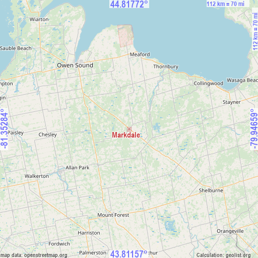
Markdale GPS coordinates[2]
44° 19' 0.48" North, 80° 38' 58.956" West
| Map corner | latitude | longitude |
|---|---|---|
| Upper-left | 44.81772°, | -81.35284° |
| Center: | 44.3168°, | -80.64971° |
| Lower-right: | 43.81157°, | -79.94659° |
| Map W x H: | 111.9×111.9 km | = 69.5×69.5mi |
| max Lat: | 73.03752° ⇑88.6% North |
| Markdale: | 44.3168° |
| min Lat: | ⇓11.4% South 42.05009° |
| min Long | Markdale | max Long |
| -139.43328° | -80.64971° | -52.70931° |
| W 42.3%⇐ | ⇒57.7% E |
Elevation
Elevation of Markdale is 424 m = 1391 ft, and this is 169.6 m = 556 ft above average elevation for this country.
| Max E: |
1518 m = 4980 ft | 20.7% |
| Markdale | 424 m 1391 ft | |
| Avg. | 254.4 m = 835 ft | |
Min E: |
-2 m = -7 ft | 79.3% |
See also: Canada elevation on elevation.city.
Geographical zone
Markdale is located in North temperate zone (between Tropic of Cancer and the Arctic Circle). Distance of this Northern Tropic circle is 2321.6 km =1442.6 mi to South.| Distance of | km | miles | from Markdale |
|---|---|---|---|
| North Pole | 5079.5 | 3156.3 | to North |
| Arctic Circle | 2473.6 | 1537 | to North |
| Tropic Cancer | 2321.6 | 1442.6 | to South |
| Equator | 4927.6 | 3061.9 | to South |


Nearby cities:
15 places around Markdale: (largest is in red/bold)
• Alliston
65.1 km =40.5 mi,  106°
106°
• Angus
61 km =37.9 mi,  89°
89°
• Anten Mills
68.6 km =42.6 mi,  74°
74°
• Collingwood
39.1 km =24.3 mi,  61°
61°
• Elmvale
68.9 km =42.8 mi, 64°
• Hanover
35.7 km =22.2 mi,  238°
238°
• Harriston
49.9 km =31 mi,  201°
201°
• Meaford
32.4 km =20.1 mi,  5°
5°
• Mildmay
47.6 km =29.6 mi,  231°
231°
• Neustadt
38.1 km =23.7 mi, 227°
• Orangeville
62.5 km =38.8 mi,  135°
135°
• Owen Sound
36.3 km =22.6 mi,  320°
320°
• Paisley
49.6 km =30.8 mi,  268°
268°
• Shelburne
44.3 km =27.5 mi,  126°
126°
• Wasaga Beach
55 km =34.2 mi, 66°
Sources, notices
• [Note1] Compared only with cities in Canada existing in our database
• [Src1] Map data: © OpenStreetMap contributors (CC-BY-SA)
• [Src2] Other city data from geonames.org with taken over terms of usage.
• [Src3] Geographical zone / Annual Mean Temperature by Robert A. Rohde @ Wikipedia
