Merritt geodata
Merritt (British Columbia) is a populated place; located in Canada in America/Vancouver (GMT-7) time zone. With population of 7,179 people, there are 397 cities with bigger population in this country. Compared to other cities in Canada, 76.9% of cities are located further ↓South; 89.6% of cities are located further →East and 86.3% of cities have lower elevation than Merritt. Note1
Administrative division(s):
- Level 1: British Columbia
- Level 2: Thompson-Nicola Regional District
- Level 3: Merritt


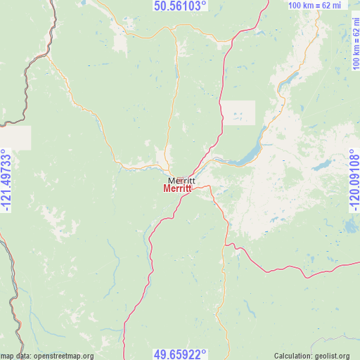
Merritt GPS coordinates[2]
50° 6' 44.1" North, 120° 47' 39.12" West
| Map corner | latitude | longitude |
|---|---|---|
| Upper-left | 50.56103°, | -121.49733° |
| Center: | 50.11225°, | -120.7942° |
| Lower-right: | 49.65922°, | -120.09108° |
| Map W x H: | 100.3×100.3 km | = 62.3×62.3mi |
| max Lat: | 73.03752° ⇑23.1% North |
| Merritt: | 50.11225° |
| min Lat: | ⇓76.9% South 42.05009° |
| min Long | Merritt | max Long |
| -139.43328° | -120.7942° | -52.70931° |
| W 10.4%⇐ | ⇒89.6% E |
Elevation
Elevation of Merritt is 593 m = 1946 ft, and this is 338.6 m = 1111 ft above average elevation for this country.
| Max E: |
1518 m = 4980 ft | 13.7% |
| Merritt | 593 m 1946 ft | |
| Avg. | 254.4 m = 835 ft | |
Min E: |
-2 m = -7 ft | 86.3% |
See also: Canada elevation on elevation.city.
Geographical zone
Merritt is located in North temperate zone (between Tropic of Cancer and the Arctic Circle). Distance of this North polar circle is 1829.2 km =1136.6 mi to North.| Distance of | km | miles | from Merritt |
|---|---|---|---|
| North Pole | 4435.1 | 2755.8 | to North |
| Arctic Circle | 1829.2 | 1136.6 | to North |
| Tropic Cancer | 2966 | 1843 | to South |
| Equator | 5572 | 3462.3 | to South |


Nearby cities:
15 places around Merritt: (largest is in red/bold)
• Ashcroft
76.3 km =47.4 mi,  333°
333°
• Cache Creek
86.2 km =53.6 mi, 334°
• Duck Lake
100.4 km =62.4 mi,  96°
96°
• Ellison
103.7 km =64.4 mi, 101°
• Falkland
98.2 km =61 mi,  63°
63°
• Hope
93.5 km =58.1 mi,  209°
209°
• Kamloops
70.2 km =43.6 mi,  28°
28°
• Kelowna
96.9 km =60.2 mi,  105°
105°
• Lillooet
103.4 km =64.2 mi,  308°
308°
• Logan Lake
43.1 km =26.8 mi,  359°
359°
• Okanagan
106.4 km =66.1 mi,  74°
74°
• Peachland
84.9 km =52.8 mi,  116°
116°
• Princeton
75.5 km =46.9 mi,  164°
164°
• Summerland
98.7 km =61.3 mi,  125°
125°
• West Kelowna
90.9 km =56.5 mi, 107°
Sources, notices
• [Note1] Compared only with cities in Canada existing in our database
• [Src1] Map data: © OpenStreetMap contributors (CC-BY-SA)
• [Src2] Other city data from geonames.org with taken over terms of usage.
• [Src3] Geographical zone / Annual Mean Temperature by Robert A. Rohde @ Wikipedia
