Cache Creek geodata
Cache Creek (British Columbia) is a populated place; located in Canada in America/Vancouver (GMT-7) time zone. With population of 1,061 people, there are 1019 cities with bigger population in this country. Compared to other cities in Canada, 81.3% of cities are located further ↓South; 90.1% of cities are located further →East and 80.4% of cities have lower elevation than Cache Creek. Note1
Administrative division(s):
- Level 1: British Columbia
- Level 2: Thompson-Nicola Regional District
- Level 3: Cache Creek


Cache Creek GPS coordinates[2]
50° 48' 36.396" North, 121° 19' 28.56" West
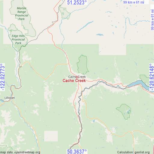
| Map corner | latitude | longitude |
|---|---|---|
| Upper-left | 51.2523°, | -122.02773° |
| Center: | 50.81011°, | -121.3246° |
| Lower-right: | 50.3637°, | -120.62148° |
| Map W x H: | 98.8×98.8 km | = 61.4×61.4mi |
| max Lat: | 73.03752° ⇑18.7% North |
| Cache Creek: | 50.81011° |
| min Lat: | ⇓81.3% South 42.05009° |
| min Long | Cache Creek | max Long |
| -139.43328° | -121.3246° | -52.70931° |
| W 9.9%⇐ | ⇒90.1% E |
Elevation
Elevation of Cache Creek is 464 m = 1522 ft, and this is 209.6 m = 688 ft above average elevation for this country.
| Max E: |
1518 m = 4980 ft | 19.6% |
| Cache Creek | 464 m 1522 ft | |
| Avg. | 254.4 m = 835 ft | |
Min E: |
-2 m = -7 ft | 80.4% |
See also: Canada elevation on elevation.city.
Geographical zone
Cache Creek is located in North temperate zone (between Tropic of Cancer and the Arctic Circle). Distance of this North polar circle is 1751.6 km =1088.4 mi to North.| Distance of | km | miles | from Cache Creek |
|---|---|---|---|
| North Pole | 4357.5 | 2707.6 | to North |
| Arctic Circle | 1751.6 | 1088.4 | to North |
| Tropic Cancer | 3043.6 | 1891.2 | to South |
| Equator | 5649.6 | 3510.5 | to South |


Nearby cities:
15 places around Cache Creek: (largest is in red/bold)
• Ashcroft
10.1 km =6.3 mi,  162°
162°
• Barrière
94 km =58.4 mi,  63°
63°
• Chase
115.1 km =71.5 mi,  89°
89°
• Clinton
35.4 km =22 mi,  328°
328°
• Falkland
129.6 km =80.5 mi,  105°
105°
• Kamloops
72.5 km =45 mi,  102°
102°
• Lillooet
45.6 km =28.3 mi,  252°
252°
• Logan Lake
50.4 km =31.3 mi,  133°
133°
• Merritt
86.2 km =53.6 mi,  154°
154°
• Mount Currie 6
108.6 km =67.5 mi,  240°
240°
• Pemberton
118 km =73.3 mi, 242°
• Salmon Arm
142.8 km =88.7 mi, 94°
• Scotch Creek
131.8 km =81.9 mi, 85°
• Whistler
138.6 km =86.1 mi, 236°
• White Lake
142.2 km =88.4 mi, 86°
Sources, notices
• [Note1] Compared only with cities in Canada existing in our database
• [Src1] Map data: © OpenStreetMap contributors (CC-BY-SA)
• [Src2] Other city data from geonames.org with taken over terms of usage.
• [Src3] Geographical zone / Annual Mean Temperature by Robert A. Rohde @ Wikipedia
