Ashcroft geodata
Ashcroft (British Columbia) is a populated place; located in Canada in America/Vancouver (GMT-7) time zone. With population of 1,796 people, there are 793 cities with bigger population in this country. Compared to other cities in Canada, 80.9% of cities are located further ↓South; 90% of cities are located further →East and 70.3% of cities have lower elevation than Ashcroft. Note1
Administrative division(s):
- Level 1: British Columbia
- Level 2: Thompson-Nicola Regional District
- Level 3: Ashcroft


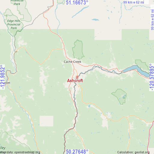
Ashcroft GPS coordinates[2]
50° 43' 25.392" North, 121° 16' 55.452" West
| Map corner | latitude | longitude |
|---|---|---|
| Upper-left | 51.16673°, | -121.9852° |
| Center: | 50.72372°, | -121.28207° |
| Lower-right: | 50.27648°, | -120.57895° |
| Map W x H: | 99×99 km | = 61.5×61.5mi |
| max Lat: | 73.03752° ⇑19.1% North |
| Ashcroft: | 50.72372° |
| min Lat: | ⇓80.9% South 42.05009° |
| min Long | Ashcroft | max Long |
| -139.43328° | -121.28207° | -52.70931° |
| W 10%⇐ | ⇒90% E |
Elevation
Elevation of Ashcroft is 307 m = 1007 ft, and this is 52.6 m = 173 ft above average elevation for this country.
| Max E: |
1518 m = 4980 ft | 29.7% |
| Ashcroft | 307 m 1007 ft | |
| Avg. | 254.4 m = 835 ft | |
Min E: |
-2 m = -7 ft | 70.3% |
See also: Canada elevation on elevation.city.
Geographical zone
Ashcroft is located in North temperate zone (between Tropic of Cancer and the Arctic Circle). Distance of this North polar circle is 1761.2 km =1094.4 mi to North.| Distance of | km | miles | from Ashcroft |
|---|---|---|---|
| North Pole | 4367.1 | 2713.6 | to North |
| Arctic Circle | 1761.2 | 1094.4 | to North |
| Tropic Cancer | 3034 | 1885.2 | to South |
| Equator | 5639.9 | 3504.5 | to South |


Nearby cities:
15 places around Ashcroft: (largest is in red/bold)
• Barrière
96.1 km =59.7 mi,  57°
57°
• Cache Creek
10.1 km =6.3 mi,  342°
342°
• Chase
112.7 km =70 mi,  84°
84°
• Clinton
45.3 km =28.1 mi,  331°
331°
• Falkland
124.6 km =77.4 mi,  101°
101°
• Kamloops
68.1 km =42.3 mi, 95°
• Lillooet
46.7 km =29 mi,  264°
264°
• Logan Lake
42 km =26.1 mi,  126°
126°
• Merritt
76.3 km =47.4 mi,  153°
153°
• Mount Currie 6
107.1 km =66.5 mi,  245°
245°
• Pemberton
116.7 km =72.5 mi, 247°
• Salmon Arm
139.4 km =86.6 mi,  91°
91°
• Scotch Creek
130 km =80.8 mi, 81°
• Whistler
136.2 km =84.6 mi,  240°
240°
• White Lake
140.2 km =87.1 mi, 82°
Sources, notices
• [Note1] Compared only with cities in Canada existing in our database
• [Src1] Map data: © OpenStreetMap contributors (CC-BY-SA)
• [Src2] Other city data from geonames.org with taken over terms of usage.
• [Src3] Geographical zone / Annual Mean Temperature by Robert A. Rohde @ Wikipedia
