Kamloops geodata
Kamloops (British Columbia) is a populated place; located in Canada in America/Vancouver (GMT-7) time zone. With population of 68,714 people, there are 82 cities with bigger population in this country. Compared to other cities in Canada, 80.6% of cities are located further ↓South; 89.4% of cities are located further →East and 78.5% of cities have lower elevation than Kamloops. Note1
Administrative division(s):
- Level 1: British Columbia
- Level 2: Thompson-Nicola Regional District
- Level 3: Kamloops


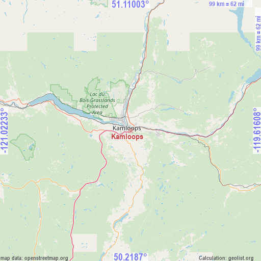
Kamloops GPS coordinates[2]
50° 39' 59.328" North, 120° 19' 9.12" West
| Map corner | latitude | longitude |
|---|---|---|
| Upper-left | 51.11003°, | -121.02233° |
| Center: | 50.66648°, | -120.3192° |
| Lower-right: | 50.2187°, | -119.61608° |
| Map W x H: | 99.1×99.1 km | = 61.6×61.6mi |
| max Lat: | 73.03752° ⇑19.4% North |
| Kamloops: | 50.66648° |
| min Lat: | ⇓80.6% South 42.05009° |
| min Long | Kamloops | max Long |
| -139.43328° | -120.3192° | -52.70931° |
| W 10.6%⇐ | ⇒89.4% E |
Elevation
Elevation of Kamloops is 414 m = 1358 ft, and this is 159.6 m = 524 ft above average elevation for this country.
| Max E: |
1518 m = 4980 ft | 21.5% |
| Kamloops | 414 m 1358 ft | |
| Avg. | 254.4 m = 835 ft | |
Min E: |
-2 m = -7 ft | 78.5% |
See also: Kamloops elevation on elevation.city.
Geographical zone
Kamloops is located in North temperate zone (between Tropic of Cancer and the Arctic Circle). Distance of this North polar circle is 1767.6 km =1098.3 mi to North.| Distance of | km | miles | from Kamloops |
|---|---|---|---|
| North Pole | 4373.5 | 2717.6 | to North |
| Arctic Circle | 1767.6 | 1098.3 | to North |
| Tropic Cancer | 3027.7 | 1881.3 | to South |
| Equator | 5633.6 | 3500.6 | to South |


Nearby cities:
15 places around Kamloops: (largest is in red/bold)
• Armstrong
82.5 km =51.3 mi,  106°
106°
• Ashcroft
68.1 km =42.3 mi,  275°
275°
• Barrière
59.1 km =36.7 mi,  13°
13°
• Cache Creek
72.5 km =45 mi, 282°
• Chase
47.6 km =29.6 mi,  69°
69°
• Enderby
83.4 km =51.8 mi,  98°
98°
• Falkland
57.2 km =35.5 mi, 108°
• Logan Lake
38.8 km =24.1 mi,  241°
241°
• Merritt
70.2 km =43.6 mi,  208°
208°
• Okanagan
76.3 km =47.4 mi,  116°
116°
• Ranchero
78.7 km =48.9 mi,  91°
91°
• Salmon Arm
71.7 km =44.6 mi, 87°
• Scotch Creek
66.2 km =41.1 mi, 66°
• Sunnybrae
74.8 km =46.5 mi,  81°
81°
• White Lake
75.4 km =46.9 mi, 71°
Sources, notices
• [Note1] Compared only with cities in Canada existing in our database
• [Src1] Map data: © OpenStreetMap contributors (CC-BY-SA)
• [Src2] Other city data from geonames.org with taken over terms of usage.
• [Src3] Geographical zone / Annual Mean Temperature by Robert A. Rohde @ Wikipedia
