Saint-Alexandre geodata
Saint-Alexandre (Quebec) is a populated place; located in Canada in America/Toronto (GMT-4) time zone. With population of 1,304 people, there are 919 cities with bigger population in this country. Compared to other cities in Canada, 74.6% of cities are located further ↑North; 55.6% of cities are located further ←West and 65.4% of cities have higher elevation than Saint-Alexandre. Note1


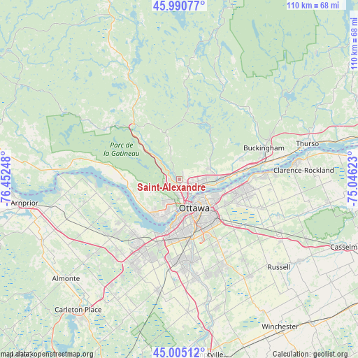
Saint-Alexandre GPS coordinates[2]
45° 30' 0.36" North, 75° 44' 57.66" West
| Map corner | latitude | longitude |
|---|---|---|
| Upper-left | 45.99077°, | -76.45248° |
| Center: | 45.5001°, | -75.74935° |
| Lower-right: | 45.00512°, | -75.04623° |
| Map W x H: | 109.6×109.6 km | = 68.1×68.1mi |
| max Lat: | 73.03752° ⇑74.6% North |
| Saint-Alexandre: | 45.5001° |
| min Lat: | ⇓25.4% South 42.05009° |
| min Long | Saint-Alexandre | max Long |
| -139.43328° | -75.74935° | -52.70931° |
| W 55.6%⇐ | ⇒44.4% E |
Elevation
Elevation of Saint-Alexandre is 74 m = 243 ft, and this is 180.4 m = 592 ft below average elevation for this country.
| Max E: |
1518 m = 4980 ft | 65.4% |
| Avg. | 254.4 m = 835 ft | |
| Saint-Alexandre | 74 m = 243 ft | |
Min E: |
-2 m = -7 ft | 34.6% |
See also: Canada elevation on elevation.city.
Geographical zone
Saint-Alexandre is located in North temperate zone (between Tropic of Cancer and the Arctic Circle). Distance of this North polar circle is 2342 km =1455.3 mi to North.| Distance of | km | miles | from Saint-Alexandre |
|---|---|---|---|
| North Pole | 4947.9 | 3074.5 | to North |
| Arctic Circle | 2342 | 1455.3 | to North |
| Tropic Cancer | 2453.2 | 1524.3 | to South |
| Equator | 5059.1 | 3143.6 | to South |


Nearby cities:
15 places around Saint-Alexandre: (largest is in red/bold)
• Bells Corners
21.4 km =13.3 mi,  197°
197°
• Buckingham
27.3 km =17 mi,  69°
69°
• Cantley
7.9 km =4.9 mi,  340°
340°
• Constance Bay
26 km =16.2 mi,  270°
270°
• Fallingbrook
20.9 km =13 mi,  97°
97°
• Gatineau
4.5 km =2.8 mi,  124°
124°
• Kanata
25.8 km =16 mi,  210°
210°
• Nepean
16.5 km =10.3 mi,  177°
177°
• Ottawa
10.7 km =6.6 mi,  157°
157°
• Queenswood Heights
19.3 km =12 mi, 99°
• Richmond
35.8 km =22.2 mi,  190°
190°
• Val-des-Monts
17.9 km =11.1 mi,  21°
21°
• Vanier
9.4 km =5.8 mi,  135°
135°
• Wakefield
19.6 km =12.2 mi, 340°
• le Plateau
7.6 km =4.7 mi, 198°
Sources, notices
• [Note1] Compared only with cities in Canada existing in our database
• [Src1] Map data: © OpenStreetMap contributors (CC-BY-SA)
• [Src2] Other city data from geonames.org with taken over terms of usage.
• [Src3] Geographical zone / Annual Mean Temperature by Robert A. Rohde @ Wikipedia
