Shawville geodata
Shawville (Quebec) is a populated place; located in Canada in America/Toronto (GMT-4) time zone. With population of 1,203 people, there are 952 cities with bigger population in this country. Compared to other cities in Canada, 71.8% of cities are located further ↑North; 54% of cities are located further ←West and 52.2% of cities have higher elevation than Shawville. Note1


Shawville GPS coordinates[2]
45° 36' 0.396" North, 76° 28' 57.72" West
| Map corner | latitude | longitude |
|---|---|---|
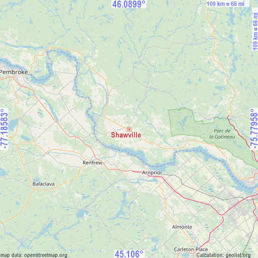
| Upper-left | 46.0899°, | -77.18583° |
| Center: | 45.60011°, | -76.4827° |
| Lower-right: | 45.106°, | -75.77958° |
| Map W x H: | 109.4×109.4 km | = 68×68mi |
| max Lat: | 73.03752° ⇑71.8% North |
| Shawville: | 45.60011° |
| min Lat: | ⇓28.2% South 42.05009° |
| min Long | Shawville | max Long |
| -139.43328° | -76.4827° | -52.70931° |
| W 54%⇐ | ⇒46% E |
Elevation
Elevation of Shawville is 159 m = 522 ft, and this is 95.4 m = 313 ft below average elevation for this country.
| Max E: |
1518 m = 4980 ft | 52.2% |
| Avg. | 254.4 m = 835 ft | |
| Shawville | 159 m = 522 ft | |
Min E: |
-2 m = -7 ft | 47.8% |
See also: Canada elevation on elevation.city.
Geographical zone
Shawville is located in North temperate zone (between Tropic of Cancer and the Arctic Circle). Distance of this North polar circle is 2330.9 km =1448.4 mi to North.| Distance of | km | miles | from Shawville |
|---|---|---|---|
| North Pole | 4936.8 | 3067.6 | to North |
| Arctic Circle | 2330.9 | 1448.4 | to North |
| Tropic Cancer | 2464.3 | 1531.2 | to South |
| Equator | 5070.3 | 3150.5 | to South |


Nearby cities:
15 places around Shawville: (largest is in red/bold)
• Arnprior
21.2 km =13.2 mi,  150°
150°
• Bells Corners
59.9 km =37.2 mi,  121°
121°
• Cantley
54.6 km =33.9 mi,  93°
93°
• Carleton Place
58.1 km =36.1 mi, 153°
• Constance Bay
33.1 km =20.6 mi,  109°
109°
• Fort-Coulonge
33.9 km =21.1 mi,  325°
325°
• Gatineau
62.3 km =38.7 mi,  102°
102°
• Kanata
55.4 km =34.4 mi,  127°
127°
• Kazabazua
53.1 km =33 mi,  42°
42°
• Pembroke
54.8 km =34.1 mi,  296°
296°
• Renfrew
21.5 km =13.4 mi,  226°
226°
• Saint-Alexandre
58.2 km =36.2 mi, 101°
• Val-des-Monts
63.7 km =39.6 mi,  84°
84°
• Wakefield
51.1 km =31.8 mi, 81°
• le Plateau
57.7 km =35.9 mi, 108°
Sources, notices
• [Note1] Compared only with cities in Canada existing in our database
• [Src1] Map data: © OpenStreetMap contributors (CC-BY-SA)
• [Src2] Other city data from geonames.org with taken over terms of usage.
• [Src3] Geographical zone / Annual Mean Temperature by Robert A. Rohde @ Wikipedia
