Shellbrook geodata
Shellbrook (Saskatchewan) is a populated place; located in Canada in America/Regina (GMT-6) time zone. With population of 1,192 people, there are 955 cities with bigger population in this country. Compared to other cities in Canada, 89.7% of cities are located further ↓South; 73% of cities are located further →East and 81.4% of cities have lower elevation than Shellbrook. Note1


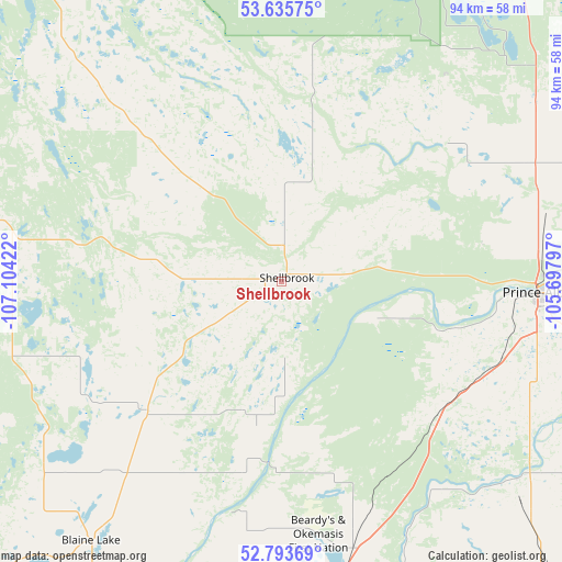
Shellbrook GPS coordinates[2]
53° 13' 0.444" North, 106° 24' 3.924" West
| Map corner | latitude | longitude |
|---|---|---|
| Upper-left | 53.63575°, | -107.10422° |
| Center: | 53.21679°, | -106.40109° |
| Lower-right: | 52.79369°, | -105.69797° |
| Map W x H: | 93.6×93.6 km | = 58.2×58.2mi |
| max Lat: | 73.03752° ⇑10.3% North |
| Shellbrook: | 53.21679° |
| min Lat: | ⇓89.7% South 42.05009° |
| min Long | Shellbrook | max Long |
| -139.43328° | -106.40109° | -52.70931° |
| W 27%⇐ | ⇒73% E |
Elevation
Elevation of Shellbrook is 494 m = 1621 ft, and this is 239.6 m = 786 ft above average elevation for this country.
| Max E: |
1518 m = 4980 ft | 18.6% |
| Shellbrook | 494 m 1621 ft | |
| Avg. | 254.4 m = 835 ft | |
Min E: |
-2 m = -7 ft | 81.4% |
See also: Canada elevation on elevation.city.
Geographical zone
Shellbrook is located in North temperate zone (between Tropic of Cancer and the Arctic Circle). Distance of this North polar circle is 1484 km =922.1 mi to North.| Distance of | km | miles | from Shellbrook |
|---|---|---|---|
| North Pole | 4089.9 | 2541.3 | to North |
| Arctic Circle | 1484 | 922.1 | to North |
| Tropic Cancer | 3311.2 | 2057.5 | to South |
| Equator | 5917.2 | 3676.8 | to South |


Nearby cities:
15 places around Shellbrook: (largest is in red/bold)
• Biggar
167.3 km =104 mi,  220°
220°
• Dalmeny
101.3 km =62.9 mi,  194°
194°
• Humboldt
142 km =88.2 mi,  142°
142°
• Langham
101.9 km =63.3 mi,  201°
201°
• Lanigan
177.9 km =110.5 mi,  148°
148°
• Martensville
105.3 km =65.4 mi, 189°
• Meadow Lake
168.3 km =104.6 mi,  307°
307°
• Melfort
125.4 km =77.9 mi,  108°
108°
• Nipawin
160.4 km =99.7 mi,  84°
84°
• North Battleford
135.8 km =84.4 mi,  249°
249°
• Prince Albert
42.2 km =26.2 mi,  92°
92°
• Rosthern
61.3 km =38.1 mi,  175°
175°
• Saskatoon
121.9 km =75.7 mi, 188°
• Tisdale
162.3 km =100.8 mi,  104°
104°
• Warman
100.7 km =62.6 mi, 186°
Sources, notices
• [Note1] Compared only with cities in Canada existing in our database
• [Src1] Map data: © OpenStreetMap contributors (CC-BY-SA)
• [Src2] Other city data from geonames.org with taken over terms of usage.
• [Src3] Geographical zone / Annual Mean Temperature by Robert A. Rohde @ Wikipedia
