Nipawin geodata
Nipawin (Saskatchewan) is a populated place; located in Canada in America/Regina (GMT-6) time zone. With population of 3,994 people, there are 534 cities with bigger population in this country. Compared to other cities in Canada, 90.6% of cities are located further ↓South; 71.4% of cities are located further →East and 75.3% of cities have lower elevation than Nipawin. Note1


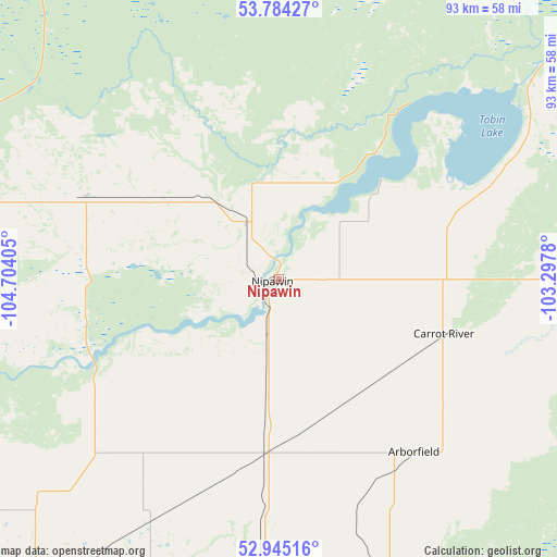
Nipawin GPS coordinates[2]
53° 22' 0.408" North, 104° 0' 3.312" West
| Map corner | latitude | longitude |
|---|---|---|
| Upper-left | 53.78427°, | -104.70405° |
| Center: | 53.36678°, | -104.00092° |
| Lower-right: | 52.94516°, | -103.2978° |
| Map W x H: | 93.3×93.3 km | = 58×58mi |
| max Lat: | 73.03752° ⇑9.4% North |
| Nipawin: | 53.36678° |
| min Lat: | ⇓90.6% South 42.05009° |
| min Long | Nipawin | max Long |
| -139.43328° | -104.00092° | -52.70931° |
| W 28.6%⇐ | ⇒71.4% E |
Elevation
Elevation of Nipawin is 361 m = 1184 ft, and this is 106.6 m = 350 ft above average elevation for this country.
| Max E: |
1518 m = 4980 ft | 24.7% |
| Nipawin | 361 m 1184 ft | |
| Avg. | 254.4 m = 835 ft | |
Min E: |
-2 m = -7 ft | 75.3% |
See also: Canada elevation on elevation.city.
Geographical zone
Nipawin is located in North temperate zone (between Tropic of Cancer and the Arctic Circle). Distance of this North polar circle is 1467.3 km =911.7 mi to North.| Distance of | km | miles | from Nipawin |
|---|---|---|---|
| North Pole | 4073.2 | 2531 | to North |
| Arctic Circle | 1467.3 | 911.7 | to North |
| Tropic Cancer | 3327.9 | 2067.9 | to South |
| Equator | 5933.8 | 3687.1 | to South |


Nearby cities:
15 places around Nipawin: (largest is in red/bold)
• Carrot River
29.2 km =18.1 mi,  108°
108°
• Foam Lake
193.5 km =120.2 mi,  170°
170°
• Hudson Bay
122.2 km =75.9 mi,  118°
118°
• Humboldt
150.2 km =93.3 mi,  210°
210°
• Kelvington
137.1 km =85.2 mi, 166°
• Lanigan
182.5 km =113.4 mi,  202°
202°
• Melfort
69.2 km =43 mi,  216°
216°
• Preeceville
181.4 km =112.7 mi,  150°
150°
• Prince Albert
118.9 km =73.9 mi,  261°
261°
• Rosthern
174.4 km =108.4 mi,  243°
243°
• Shellbrook
160.4 km =99.7 mi, 264°
• The Pas
188.3 km =117 mi,  74°
74°
• Tisdale
57.6 km =35.8 mi,  183°
183°
• Wadena
158.1 km =98.2 mi, 175°
• Wynyard
178.3 km =110.8 mi, 183°
Sources, notices
• [Note1] Compared only with cities in Canada existing in our database
• [Src1] Map data: © OpenStreetMap contributors (CC-BY-SA)
• [Src2] Other city data from geonames.org with taken over terms of usage.
• [Src3] Geographical zone / Annual Mean Temperature by Robert A. Rohde @ Wikipedia
