Ucluelet geodata
Ucluelet (British Columbia) is a populated place; located in Canada in America/Vancouver (GMT-7) time zone. With population of 1,566 people, there are 844 cities with bigger population in this country. Compared to other cities in Canada, 61.4% of cities are located further ↓South; 98.1% of cities are located further →East and 84.1% of cities have higher elevation than Ucluelet. Note1
Administrative division(s):
- Level 1: British Columbia
- Level 2: Regional District of Alberni-Clayoquot
- Level 3: Ucluelet


Ucluelet GPS coordinates[2]
48° 56' 29.508" North, 125° 32' 46.86" West
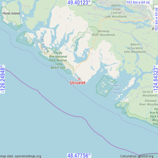
| Map corner | latitude | longitude |
|---|---|---|
| Upper-left | 49.40123°, | -126.24948° |
| Center: | 48.94153°, | -125.54635° |
| Lower-right: | 48.47756°, | -124.84323° |
| Map W x H: | 102.7×102.7 km | = 63.8×63.8mi |
| max Lat: | 73.03752° ⇑38.6% North |
| Ucluelet: | 48.94153° |
| min Lat: | ⇓61.4% South 42.05009° |
| min Long | Ucluelet | max Long |
| -139.43328° | -125.54635° | -52.70931° |
| W 1.9%⇐ | ⇒98.1% E |
Elevation
Elevation of Ucluelet is 24 m = 79 ft, and this is 230.4 m = 756 ft below average elevation for this country.
| Max E: |
1518 m = 4980 ft | 84.1% |
| Avg. | 254.4 m = 835 ft | |
| Ucluelet | 24 m = 79 ft | |
Min E: |
-2 m = -7 ft | 15.9% |
See also: Canada elevation on elevation.city.
Geographical zone
Ucluelet is located in North temperate zone (between Tropic of Cancer and the Arctic Circle). Distance of this North polar circle is 1959.4 km =1217.5 mi to North.| Distance of | km | miles | from Ucluelet |
|---|---|---|---|
| North Pole | 4565.3 | 2836.7 | to North |
| Arctic Circle | 1959.4 | 1217.5 | to North |
| Tropic Cancer | 2835.9 | 1762.1 | to South |
| Equator | 5441.8 | 3381.4 | to South |


Nearby cities:
15 places around Ucluelet: (largest is in red/bold)
• Coombs
91.2 km =56.7 mi,  64°
64°
• Courtenay
92 km =57.2 mi,  25°
25°
• Cumberland
83.7 km =52 mi, 26°
• Dashwood
88.4 km =54.9 mi, 57°
• Denman Island
84.3 km =52.4 mi,  38°
38°
• Denman Island Trust Area
86.9 km =54 mi, 38°
• Englishman River South
99.5 km =61.8 mi,  67°
67°
• French Creek
97.4 km =60.5 mi, 62°
• Hornby Island
91.7 km =57 mi, 44°
• Parksville
98.9 km =61.5 mi, 64°
• Port Alberni
63.6 km =39.5 mi, 58°
• Puntledge
87.6 km =54.4 mi,  23°
23°
• Royston
89.7 km =55.7 mi, 29°
• Tofino
35.3 km =21.9 mi,  311°
311°
• Youbou
98.6 km =61.3 mi,  94°
94°
Sources, notices
• [Note1] Compared only with cities in Canada existing in our database
• [Src1] Map data: © OpenStreetMap contributors (CC-BY-SA)
• [Src2] Other city data from geonames.org with taken over terms of usage.
• [Src3] Geographical zone / Annual Mean Temperature by Robert A. Rohde @ Wikipedia
