Matane geodata
Matane (Quebec) is a populated place; located in Canada in America/Toronto (GMT-4) time zone. With population of 14,812 people, there are 246 cities with bigger population in this country. Compared to other cities in Canada, 60.5% of cities are located further ↓South; 85.5% of cities are located further ←West and 65.4% of cities have higher elevation than Matane. Note1


Matane GPS coordinates[2]
48° 49' 42.852" North, 67° 31' 19.092" West
| Map corner | latitude | longitude |
|---|---|---|
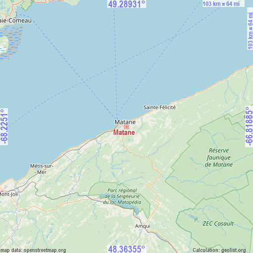
| Upper-left | 49.28931°, | -68.2251° |
| Center: | 48.82857°, | -67.52197° |
| Lower-right: | 48.36355°, | -66.81885° |
| Map W x H: | 102.9×102.9 km | = 63.9×63.9mi |
| max Lat: | 73.03752° ⇑39.5% North |
| Matane: | 48.82857° |
| min Lat: | ⇓60.5% South 42.05009° |
| min Long | Matane | max Long |
| -139.43328° | -67.52197° | -52.70931° |
| W 85.5%⇐ | ⇒14.5% E |
Elevation
Elevation of Matane is 74 m = 243 ft, and this is 180.4 m = 592 ft below average elevation for this country.
| Max E: |
1518 m = 4980 ft | 65.4% |
| Avg. | 254.4 m = 835 ft | |
| Matane | 74 m = 243 ft | |
Min E: |
-2 m = -7 ft | 34.6% |
See also: Canada elevation on elevation.city.
Geographical zone
Matane is located in North temperate zone (between Tropic of Cancer and the Arctic Circle). Distance of this North polar circle is 1971.9 km =1225.3 mi to North.| Distance of | km | miles | from Matane |
|---|---|---|---|
| North Pole | 4577.8 | 2844.5 | to North |
| Arctic Circle | 1971.9 | 1225.3 | to North |
| Tropic Cancer | 2823.3 | 1754.3 | to South |
| Equator | 5429.2 | 3373.5 | to South |


Nearby cities:
15 places around Matane: (largest is in red/bold)
• Amqui
41.1 km =25.5 mi,  170°
170°
• Baie-Comeau
62.9 km =39.1 mi,  313°
313°
• Campbellton
110.7 km =68.8 mi,  145°
145°
• Cap-Chat
68.3 km =42.4 mi,  63°
63°
• Carleton-sur-Mer
130.3 km =81 mi,  127°
127°
• Chute-aux-Outardes
71.6 km =44.5 mi,  296°
296°
• Forestville
114.9 km =71.4 mi,  264°
264°
• Hauterive
67.4 km =41.9 mi, 307°
• Lac-des-Aigles
126.3 km =78.5 mi,  222°
222°
• Le Bic
99.8 km =62 mi,  239°
239°
• Luceville
71.5 km =44.4 mi, 243°
• Mont-Joli
56.2 km =34.9 mi, 241°
• Rimouski
84.9 km =52.8 mi, 240°
• Saint-Mathieu-de-Rioux
129.6 km =80.5 mi, 236°
• Sainte-Anne-des-Monts
82 km =51 mi,  66°
66°
Sources, notices
• [Note1] Compared only with cities in Canada existing in our database
• [Src1] Map data: © OpenStreetMap contributors (CC-BY-SA)
• [Src2] Other city data from geonames.org with taken over terms of usage.
• [Src3] Geographical zone / Annual Mean Temperature by Robert A. Rohde @ Wikipedia
