Sainte-Anne-des-Monts geodata
Sainte-Anne-des-Monts (Quebec) is a populated place; located in Canada in America/Toronto (GMT-4) time zone. With population of 5,602 people, there are 447 cities with bigger population in this country. Compared to other cities in Canada, 64.1% of cities are located further ↓South; 87.2% of cities are located further ←West and 90% of cities have higher elevation than Sainte-Anne-des-Monts. Note1
Administrative division(s):
- Level 1: Quebec
- Level 2: Gaspésie-Îles-de-la-Madeleine
- Level 3: Sainte-Anne-des-Monts


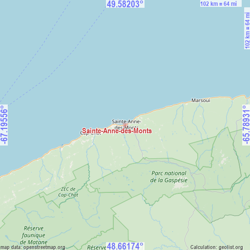
Sainte-Anne-des-Monts GPS coordinates[2]
49° 7' 26.472" North, 66° 29' 32.748" West
| Map corner | latitude | longitude |
|---|---|---|
| Upper-left | 49.58203°, | -67.19556° |
| Center: | 49.12402°, | -66.49243° |
| Lower-right: | 48.66174°, | -65.78931° |
| Map W x H: | 102.3×102.3 km | = 63.6×63.6mi |
| max Lat: | 73.03752° ⇑35.9% North |
| Sainte-Anne-des-Monts: | 49.12402° |
| min Lat: | ⇓64.1% South 42.05009° |
| min Long | Sainte-Anne-des | max Long |
| -139.43328° | -66.49243° | -52.70931° |
| W 87.2%⇐ | ⇒12.8% E |
Elevation
Elevation of Sainte-Anne-des-Monts is 15 m = 49 ft, and this is 239.4 m = 785 ft below average elevation for this country.
| Max E: |
1518 m = 4980 ft | 90% |
| Avg. | 254.4 m = 835 ft | |
| Sainte-Anne-des-Monts | 15 m = 49 ft | |
Min E: |
-2 m = -7 ft | 10% |
See also: Canada elevation on elevation.city.
Geographical zone
Sainte-Anne-des-Monts is located in North temperate zone (between Tropic of Cancer and the Arctic Circle). Distance of this North polar circle is 1939.1 km =1204.9 mi to North.| Distance of | km | miles | from Sainte-Anne-des-Monts |
|---|---|---|---|
| North Pole | 4545 | 2824.1 | to North |
| Arctic Circle | 1939.1 | 1204.9 | to North |
| Tropic Cancer | 2856.2 | 1774.8 | to South |
| Equator | 5462.1 | 3394 | to South |


Nearby cities:
15 places around Sainte-Anne-des-Monts: (largest is in red/bold)
• Amqui
100.6 km =62.5 mi,  223°
223°
• Baie-Comeau
120.9 km =75.1 mi,  274°
274°
• Campbellton
124.9 km =77.6 mi,  186°
186°
• Cap-Chat
14.1 km =8.8 mi,  259°
259°
• Carleton
117.6 km =73.1 mi,  165°
165°
• Carleton-sur-Mer
116.2 km =72.2 mi, 166°
• Hauterive
128.6 km =79.9 mi, 273°
• Maliotenam
122.9 km =76.4 mi,  10°
10°
• Maria
111.9 km =69.5 mi,  160°
160°
• Matane
82 km =51 mi,  246°
246°
• Murdochville
74.6 km =46.4 mi,  104°
104°
• New-Richmond
116.8 km =72.6 mi, 156°
• Port-Cartier
104.6 km =65 mi,  345°
345°
• Saint-Alexandre
103.7 km =64.4 mi, 345°
• Sept-Îles
119.9 km =74.5 mi,  3°
3°
Sources, notices
• [Note1] Compared only with cities in Canada existing in our database
• [Src1] Map data: © OpenStreetMap contributors (CC-BY-SA)
• [Src2] Other city data from geonames.org with taken over terms of usage.
• [Src3] Geographical zone / Annual Mean Temperature by Robert A. Rohde @ Wikipedia
