Zumikon geodata
Zumikon (Zurich) is a populated place; located in Switzerland in Europe/Zurich (GMT+2) time zone. With population of 4,424 people, there are 391 cities with bigger population in this country. Compared to other cities in Switzerland, 62.4% of cities are located further ↓South; 68.4% of cities are located further ←West and 79% of cities have lower elevation than Zumikon. Note1


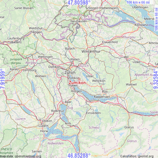
Zumikon GPS coordinates[2]
47° 19' 53.688" North, 8° 37' 21.756" East
| Map corner | latitude | longitude |
|---|---|---|
| Upper-left | 47.80598°, | 7.91959° |
| Center: | 47.33158°, | 8.62271° |
| Lower-right: | 46.85288°, | 9.32584° |
| Map W x H: | 106×106 km | = 65.9×65.9mi |
| max Lat: | 47.76737° ⇑37.6% North |
| Zumikon: | 47.33158° |
| min Lat: | ⇓62.4% South 45.83203° |
| min Long | Zumikon | max Long |
| 5.97153° | 8.62271° | 10.44624° |
| W 68.4%⇐ | ⇒31.6% E |
Elevation
Elevation of Zumikon is 649 m = 2129 ft, and this is 90.8 m = 298 ft above average elevation for this country.
| Max E: |
1845 m = 6053 ft | 21% |
| Zumikon | 649 m 2129 ft | |
| Avg. | 558.2 m = 1831 ft | |
Min E: |
197 m = 646 ft | 79% |
See also: Switzerland elevation on elevation.city.
Geographical zone
Zumikon is located in North temperate zone (between Tropic of Cancer and the Arctic Circle). Distance of this North polar circle is 2138.4 km =1328.7 mi to North.| Distance of | km | miles | from Zumikon |
|---|---|---|---|
| North Pole | 4744.3 | 2948 | to North |
| Arctic Circle | 2138.4 | 1328.7 | to North |
| Tropic Cancer | 2656.9 | 1650.9 | to South |
| Equator | 5262.8 | 3270.2 | to South |


Nearby cities:
15 places around Zumikon: (largest is in red/bold)
• Aesch
2.4 km =1.5 mi,  95°
95°
• Binz
2.8 km =1.7 mi,  6°
6°
• Ebmatingen
2.4 km =1.5 mi,  32°
32°
• Ebmatingen / Bachtobel
2.7 km =1.7 mi, 30°
• Ebmatingen / Lebern
2.4 km =1.5 mi,  37°
37°
• Erlenbach / rechts des Dorfbachs oberhalb Bahnlinie
3.2 km =2 mi,  208°
208°
• Küsnacht
3.3 km =2.1 mi,  242°
242°
• Küsnacht / Allmend
2.7 km =1.7 mi,  225°
225°
• Küsnacht / Goldbach
3.2 km =2 mi,  261°
261°
• Küsnacht / Heslibach
3.3 km =2.1 mi, 231°
• Küsnacht / Itschnach
1.7 km =1.1 mi,  253°
253°
• Küsnacht / Schiedhalden
2.8 km =1.7 mi, 245°
• Scheuren
2.9 km =1.8 mi,  106°
106°
• Zollikerberg
2.2 km =1.4 mi,  312°
312°
• Zumikon / Fröschgüllen
0.8 km =0.5 mi, 314°
Sources, notices
• [Note1] Compared only with cities in Switzerland existing in our database
• [Src1] Map data: © OpenStreetMap contributors (CC-BY-SA)
• [Src2] Other city data from geonames.org with taken over terms of usage.
• [Src3] Geographical zone / Annual Mean Temperature by Robert A. Rohde @ Wikipedia
