Erlenbach / rechts des Dorfbachs oberhalb Bahnlinie geodata
Erlenbach / rechts des Dorfbachs oberhalb Bahnlinie (Zurich) is a section of populated place; located in Switzerland in Europe/Zurich (GMT+2) time zone. With population of 1,470 people, there are 1049 cities with bigger population in this country. Compared to other cities in Switzerland, 58.9% of cities are located further ↓South; 66.7% of cities are located further ←West and 62.5% of cities have lower elevation than Erlenbach / rechts des Dorfbachs oberhalb Bahnlinie. Note1
Current local time in Erlenbach / rechts des Dorfbachs oberhalb Bahnlinie:
07:37 AM, SaturdayDifference from your time zone: hours


Erlenbach / rechts des Dorfbachs oberhalb Bahnlinie GPS coordinates[2]
47° 18' 23.688" North, 8° 36' 9.756" East
| Map corner | latitude | longitude |
|---|---|---|
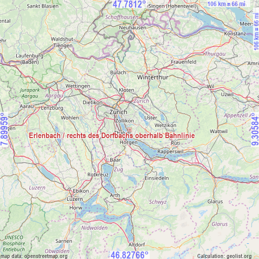
| Upper-left | 47.7812°, | 7.89959° |
| Center: | 47.30658°, | 8.60271° |
| Lower-right: | 46.82766°, | 9.30584° |
| Map W x H: | 106×106 km | = 65.9×65.9mi |
| max Lat: | 47.76737° ⇑41.1% North |
| Erlenbach / rechts des Dorfbachs oberhalb Bahnlinie: | 47.30658° |
| min Lat: | ⇓58.9% South 45.83203° |
| min Long | Erlenbach / rec | max Long |
| 5.97153° | 8.60271° | 10.44624° |
| W 66.7%⇐ | ⇒33.3% E |
Elevation
Elevation of Erlenbach / rechts des Dorfbachs oberhalb Bahnlinie is 533 m = 1749 ft, and this is 25.2 m = 83 ft below average elevation for this country.
| Max E: |
1845 m = 6053 ft | 37.5% |
| Avg. | 558.2 m = 1831 ft | |
| Erlenbach / rechts des Dorfbachs oberhalb Bahnlinie | 533 m = 1749 ft | |
Min E: |
197 m = 646 ft | 62.5% |
See also: Switzerland elevation on elevation.city.
Geographical zone
Erlenbach / rechts des Dorfbachs oberhalb Bahnlinie is located in North temperate zone (between Tropic of Cancer and the Arctic Circle). Distance of this North polar circle is 2141.2 km =1330.5 mi to North.| Distance of | km | miles | from Erlenbach / rechts des Dorfbachs oberhalb Bahnlinie |
|---|---|---|---|
| North Pole | 4747.1 | 2949.7 | to North |
| Arctic Circle | 2141.2 | 1330.5 | to North |
| Tropic Cancer | 2654.1 | 1649.2 | to South |
| Equator | 5260 | 3268.4 | to South |


Nearby cities:
15 places around Erlenbach / rechts des Dorfbachs oberhalb Bahnlinie: (largest is in red/bold)
• Erlenbach
0.6 km =0.4 mi,  224°
224°
• Erlenbach / links des Dorfbachs oberhalb Bahnlinie
0.8 km =0.5 mi,  184°
184°
• Erlenbach / links des Dorfbachs unterhalb Bahnlinie
0.9 km =0.6 mi, 221°
• Erlenbach / rechts des Dorfbachs unterhalb Bahnlinie
0.9 km =0.6 mi,  261°
261°
• Herrliberg
2 km =1.2 mi,  153°
153°
• Küsnacht
1.9 km =1.2 mi,  312°
312°
• Küsnacht / Allmend
1 km =0.6 mi,  336°
336°
• Küsnacht / Dorf
1.9 km =1.2 mi, 310°
• Küsnacht / Goldbach
2.8 km =1.7 mi,  324°
324°
• Küsnacht / Heslibach
1.3 km =0.8 mi,  303°
303°
• Küsnacht / Itschnach
2.3 km =1.4 mi,  356°
356°
• Küsnacht / Schiedhalden
1.9 km =1.2 mi,  327°
327°
• Thalwil / Dorfkern
3.3 km =2.1 mi,  236°
236°
• Thalwil / See
2.9 km =1.8 mi, 241°
• Zumikon
3.2 km =2 mi,  28°
28°
Sources, notices
• [Note1] Compared only with cities in Switzerland existing in our database
• [Src1] Map data: © OpenStreetMap contributors (CC-BY-SA)
• [Src2] Other city data from geonames.org with taken over terms of usage.
• [Src3] Geographical zone / Annual Mean Temperature by Robert A. Rohde @ Wikipedia
