Wiedlisbach geodata
Wiedlisbach (Bern) is a populated place; located in Switzerland in Europe/Zurich (GMT+2) time zone. With population of 2,213 people, there are 769 cities with bigger population in this country. Compared to other cities in Switzerland, 51.9% of cities are located further ↓South; 70.1% of cities are located further →East and 53% of cities have higher elevation than Wiedlisbach. Note1


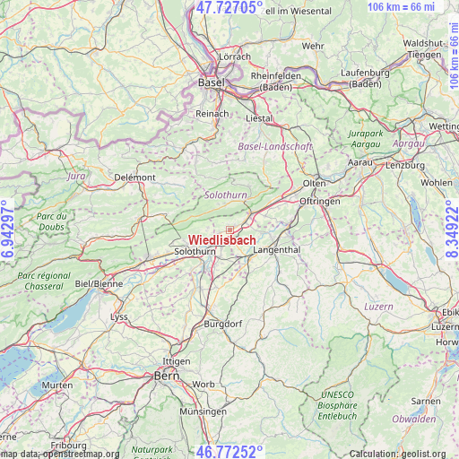
Wiedlisbach GPS coordinates[2]
47° 15' 6.984" North, 7° 38' 45.96" East
| Map corner | latitude | longitude |
|---|---|---|
| Upper-left | 47.72705°, | 6.94297° |
| Center: | 47.25194°, | 7.6461° |
| Lower-right: | 46.77252°, | 8.34922° |
| Map W x H: | 106.1×106.1 km | = 65.9×65.9mi |
| max Lat: | 47.76737° ⇑48.1% North |
| Wiedlisbach: | 47.25194° |
| min Lat: | ⇓51.9% South 45.83203° |
| min Long | Wiedlisbach | max Long |
| 5.97153° | 7.6461° | 10.44624° |
| W 29.9%⇐ | ⇒70.1% E |
Elevation
Elevation of Wiedlisbach is 471 m = 1545 ft, and this is 87.2 m = 286 ft below average elevation for this country.
| Max E: |
1845 m = 6053 ft | 53% |
| Avg. | 558.2 m = 1831 ft | |
| Wiedlisbach | 471 m = 1545 ft | |
Min E: |
197 m = 646 ft | 47% |
See also: Switzerland elevation on elevation.city.
Geographical zone
Wiedlisbach is located in North temperate zone (between Tropic of Cancer and the Arctic Circle). Distance of this North polar circle is 2147.3 km =1334.3 mi to North.| Distance of | km | miles | from Wiedlisbach |
|---|---|---|---|
| North Pole | 4753.1 | 2953.4 | to North |
| Arctic Circle | 2147.3 | 1334.3 | to North |
| Tropic Cancer | 2648 | 1645.4 | to South |
| Equator | 5253.9 | 3264.6 | to South |


Nearby cities:
15 places around Wiedlisbach: (largest is in red/bold)
• Aedermannsdorf
6.4 km =4 mi,  335°
335°
• Attiswil
2.5 km =1.6 mi,  256°
256°
• Bannwil
6.9 km =4.3 mi,  101°
101°
• Deitingen
4.6 km =2.9 mi,  206°
206°
• Herbetswil
6.4 km =4 mi,  320°
320°
• Laupersdorf
6.8 km =4.2 mi,  5°
5°
• Luterbach
6.3 km =3.9 mi,  227°
227°
• Matzendorf
5.9 km =3.7 mi,  346°
346°
• Niederbipp
4.4 km =2.7 mi,  59°
59°
• Oberbipp
1.6 km =1 mi,  53°
53°
• Oensingen
6.6 km =4.1 mi, 53°
• Riedholz
6.3 km =3.9 mi,  248°
248°
• Subingen
6.3 km =3.9 mi,  198°
198°
• Walliswil bei Niederbipp
3.7 km =2.3 mi,  117°
117°
• Wangen an der Aare
2.3 km =1.4 mi,  167°
167°
Sources, notices
• [Note1] Compared only with cities in Switzerland existing in our database
• [Src1] Map data: © OpenStreetMap contributors (CC-BY-SA)
• [Src2] Other city data from geonames.org with taken over terms of usage.
• [Src3] Geographical zone / Annual Mean Temperature by Robert A. Rohde @ Wikipedia
