Attiswil geodata
Attiswil (Bern) is a populated place; located in Switzerland in Europe/Zurich (GMT+2) time zone. With population of 1,389 people, there are 1090 cities with bigger population in this country. Compared to other cities in Switzerland, 51.4% of cities are located further ↓South; 71.3% of cities are located further →East and 55.1% of cities have higher elevation than Attiswil. Note1


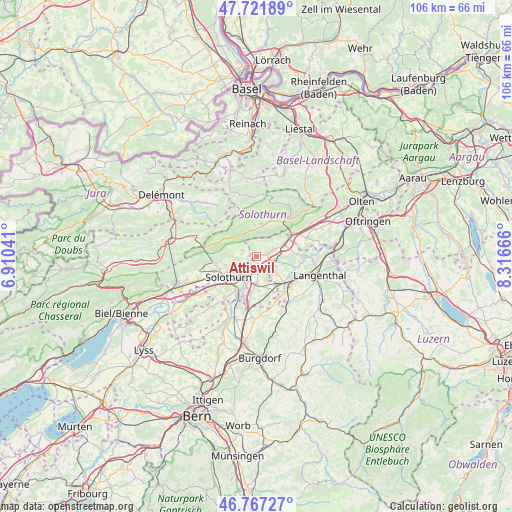
Attiswil GPS coordinates[2]
47° 14' 48.228" North, 7° 36' 48.708" East
| Map corner | latitude | longitude |
|---|---|---|
| Upper-left | 47.72189°, | 6.91041° |
| Center: | 47.24673°, | 7.61353° |
| Lower-right: | 46.76727°, | 8.31666° |
| Map W x H: | 106.1×106.1 km | = 65.9×65.9mi |
| max Lat: | 47.76737° ⇑48.6% North |
| Attiswil: | 47.24673° |
| min Lat: | ⇓51.4% South 45.83203° |
| min Long | Attiswil | max Long |
| 5.97153° | 7.61353° | 10.44624° |
| W 28.7%⇐ | ⇒71.3% E |
Elevation
Elevation of Attiswil is 467 m = 1532 ft, and this is 91.2 m = 299 ft below average elevation for this country.
| Max E: |
1845 m = 6053 ft | 55.1% |
| Avg. | 558.2 m = 1831 ft | |
| Attiswil | 467 m = 1532 ft | |
Min E: |
197 m = 646 ft | 44.9% |
See also: Switzerland elevation on elevation.city.
Geographical zone
Attiswil is located in North temperate zone (between Tropic of Cancer and the Arctic Circle). Distance of this North polar circle is 2147.8 km =1334.6 mi to North.| Distance of | km | miles | from Attiswil |
|---|---|---|---|
| North Pole | 4753.7 | 2953.8 | to North |
| Arctic Circle | 2147.8 | 1334.6 | to North |
| Tropic Cancer | 2647.4 | 1645 | to South |
| Equator | 5253.3 | 3264.2 | to South |


Nearby cities:
15 places around Attiswil: (largest is in red/bold)
• Aedermannsdorf
6.3 km =3.9 mi,  357°
357°
• Deitingen
3.5 km =2.2 mi,  173°
173°
• Derendingen
5.7 km =3.5 mi,  199°
199°
• Herbetswil
5.7 km =3.5 mi,  344°
344°
• Luterbach
4.2 km =2.6 mi,  211°
211°
• Matzendorf
6.4 km =4 mi,  9°
9°
• Niederbipp
6.8 km =4.2 mi,  65°
65°
• Oberbipp
4.1 km =2.5 mi, 67°
• Riedholz
3.8 km =2.4 mi,  243°
243°
• Solothurn
7.2 km =4.5 mi,  233°
233°
• Subingen
5.4 km =3.4 mi,  175°
175°
• Walliswil bei Niederbipp
5.9 km =3.7 mi,  101°
101°
• Wangen an der Aare
3.4 km =2.1 mi,  118°
118°
• Wiedlisbach
2.5 km =1.6 mi,  76°
76°
• Zuchwil
6.1 km =3.8 mi,  215°
215°
Sources, notices
• [Note1] Compared only with cities in Switzerland existing in our database
• [Src1] Map data: © OpenStreetMap contributors (CC-BY-SA)
• [Src2] Other city data from geonames.org with taken over terms of usage.
• [Src3] Geographical zone / Annual Mean Temperature by Robert A. Rohde @ Wikipedia
