Unteriberg geodata
Unteriberg (Schwyz) is a populated place; located in Switzerland in Europe/Zurich (GMT+2) time zone. With population of 2,307 people, there are 736 cities with bigger population in this country. Compared to other cities in Switzerland, 60.9% of cities are located further ↑North; 81.6% of cities are located further ←West and 92.8% of cities have lower elevation than Unteriberg. Note1


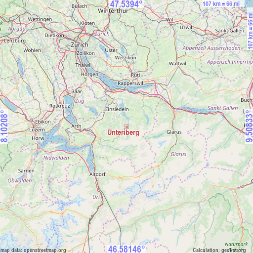
Unteriberg GPS coordinates[2]
47° 3' 45.288" North, 8° 48' 18.72" East
| Map corner | latitude | longitude |
|---|---|---|
| Upper-left | 47.5394°, | 8.10208° |
| Center: | 47.06258°, | 8.8052° |
| Lower-right: | 46.58146°, | 9.50833° |
| Map W x H: | 106.5×106.5 km | = 66.2×66.2mi |
| max Lat: | 47.76737° ⇑60.9% North |
| Unteriberg: | 47.06258° |
| min Lat: | ⇓39.1% South 45.83203° |
| min Long | Unteriberg | max Long |
| 5.97153° | 8.8052° | 10.44624° |
| W 81.6%⇐ | ⇒18.4% E |
Elevation
Elevation of Unteriberg is 922 m = 3025 ft, and this is 363.8 m = 1194 ft above average elevation for this country.
| Max E: |
1845 m = 6053 ft | 7.2% |
| Unteriberg | 922 m 3025 ft | |
| Avg. | 558.2 m = 1831 ft | |
Min E: |
197 m = 646 ft | 92.8% |
See also: Switzerland elevation on elevation.city.
Geographical zone
Unteriberg is located in North temperate zone (between Tropic of Cancer and the Arctic Circle). Distance of this North polar circle is 2168.3 km =1347.3 mi to North.| Distance of | km | miles | from Unteriberg |
|---|---|---|---|
| North Pole | 4774.2 | 2966.5 | to North |
| Arctic Circle | 2168.3 | 1347.3 | to North |
| Tropic Cancer | 2626.9 | 1632.3 | to South |
| Equator | 5232.9 | 3251.6 | to South |


Nearby cities:
15 places around Unteriberg: (largest is in red/bold)
• Alpthal
6.8 km =4.2 mi,  276°
276°
• Altendorf
14.4 km =8.9 mi,  10°
10°
• Einsiedeln
8.5 km =5.3 mi,  329°
329°
• Feusisberg
14.5 km =9 mi,  342°
342°
• Ibach
13.4 km =8.3 mi,  244°
244°
• Illgau
10.3 km =6.4 mi,  216°
216°
• Muotathal
10 km =6.2 mi,  197°
197°
• Oberiberg
3.3 km =2.1 mi, 216°
• Rothenthurm
10.8 km =6.7 mi,  295°
295°
• Sattel
13 km =8.1 mi, 279°
• Schindellegi
14.3 km =8.9 mi, 330°
• Schwyz
12.4 km =7.7 mi,  247°
247°
• Siebnen
14.3 km =8.9 mi,  29°
29°
• Steinen
14.7 km =9.1 mi,  264°
264°
• Vorderthal
9.9 km =6.2 mi,  48°
48°
Sources, notices
• [Note1] Compared only with cities in Switzerland existing in our database
• [Src1] Map data: © OpenStreetMap contributors (CC-BY-SA)
• [Src2] Other city data from geonames.org with taken over terms of usage.
• [Src3] Geographical zone / Annual Mean Temperature by Robert A. Rohde @ Wikipedia
